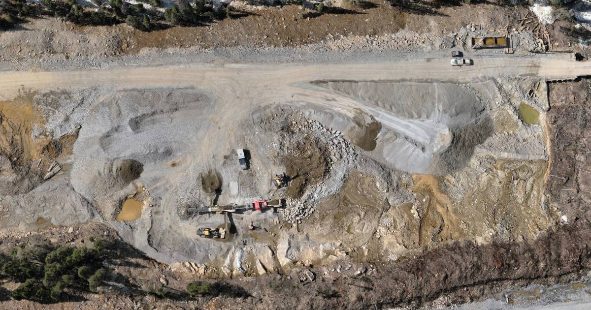
Accurate stockpile volumes are critical for inventory tracking, production reporting, reconciliation, billing, and operational planning. But the method used to calculate those volumes can dramatically change how long the survey takes, how much the site is disrupted, and how useful the final dataset becomes.
Today, many companies can choose between UAV LiDAR, photogrammetry, and traditional GPS surveying. Each method has advantages — but they do not perform equally across all sites.
Bottom line: traditional GPS still works, but UAV-based methods are dramatically faster on large sites. LiDAR is often the strongest choice when surface detail, low texture, or difficult conditions are involved, while photogrammetry remains a strong value option on suitable stockpiles.
Why Stockpile Volumetrics Matter
Stockpile volume calculations are not just a one-time survey deliverable. They directly affect day-to-day business decisions.
- Inventory measurement and reporting
- Material reconciliation and production tracking
- Project billing and subcontractor verification
- Site planning and operational forecasting
When the method is too slow or too limited, the company either receives less data than it needs — or spends more time and money collecting it.
The Three Main Methods
1. Traditional GPS Surveying
This method uses a rover and field crew to collect spot elevations across the stockpile manually.
- Well-understood workflow
- Good control on selected points
- Very labor-intensive on large or numerous stockpiles
2. Photogrammetry
A drone captures overlapping imagery, and software reconstructs the stockpile surface into a dense model for volume calculation.
- Fast data collection
- Excellent orthophotos and visual outputs
- Strong option for open, well-textured material piles
3. UAV LiDAR
A LiDAR-equipped UAV captures dense point cloud data directly, creating a surface model that is highly effective even where image-based methods become less reliable.
- Strong surface coverage and consistent geometry
- Works well in low-texture or visually difficult conditions
- Useful when a site needs both volumetrics and broader terrain capture
Traditional GPS: Reliable, But Slow
Traditional GPS surveying is still common because it is simple and familiar. But for stockpile work, especially when multiple piles are involved, it quickly becomes inefficient.
- Field crews must physically walk the site
- Point spacing affects the quality of the final surface
- It is difficult to capture the entire pile evenly and densely
- Large sites take much longer to survey
Main limitation: GPS only captures the points you physically measure. UAV methods capture the entire surface.
Photogrammetry: Fast and Cost-Effective
Photogrammetry is often a very strong choice for stockpile volumetrics when the site conditions are suitable. It is fast, efficient, and produces excellent visual outputs in addition to the volume result.
- Fast capture of large areas
- Creates orthomosaics and visual site documentation
- Very efficient for open, unobstructed piles
However, photogrammetry depends on the visible surface. If the pile has poor texture, reflective material, shadow issues, or complex edges, the resulting model may be less reliable than LiDAR.
UAV LiDAR: Strongest for Complex Conditions
UAV LiDAR is often the most robust method for stockpile volumetrics when consistency and site adaptability matter most. It is particularly valuable when stockpiles are irregular, low in texture, or part of a larger survey area that also needs surrounding terrain capture.
- Direct 3D measurement of the pile surface
- Less dependent on image texture and lighting consistency
- Efficient for large sites and repeated monitoring
- Can support both volumetrics and broader topo deliverables in one mission
Direct Comparison
| Feature | UAV LiDAR | Photogrammetry | Traditional GPS |
|---|---|---|---|
| Site coverage speed | ✓ Very fast | ✓ Very fast | Slow |
| Full surface coverage | ✓ Yes | ✓ Yes | Point-based only |
| Visual deliverables | Limited / optional | ✓ Excellent | Minimal |
| Performance on low-texture material | ✓ Strong | Can be limited | ✓ Reliable |
| Large-site efficiency | ✓ Excellent | ✓ Excellent | Poor |
| Field labor required | ✓ Low | ✓ Low | High |
When Each Method Wins
Use Traditional GPS When:
- The site is very small
- Only a limited number of points are needed
- Drone use is not possible for operational reasons
Use Photogrammetry When:
- The stockpiles are open and visually suitable
- You want both volume results and orthophotos
- Cost efficiency is a major priority
Use UAV LiDAR When:
- The surface is complex or visually difficult
- You need highly reliable 3D surface capture
- The project includes both volumetrics and surrounding terrain mapping
Practical reality: on most medium to large sites, UAV methods outperform traditional GPS in productivity by a wide margin.
How Companies Save Time and Money
The value of UAV-based volumetrics is not just in the final number. It is in how quickly the site can be captured, how much less field labor is needed, and how much more complete the deliverable becomes.
- Faster capture of multiple stockpiles in one visit
- Reduced crew time walking active sites
- More complete and reviewable surface models
- Additional site context for planning and reporting
For many operators, the real savings come from turning a time-consuming field exercise into a fast, repeatable workflow that can be done more often and with less disruption.
Why Convex Geomatics
Convex Geomatics helps clients choose the right volumetric method based on actual site conditions — not just the most familiar workflow. Whether the project is an aggregate stockpile, an earthworks site, or a broader topographic survey with volume deliverables, we provide practical geospatial solutions that save time and improve confidence in the result.
- UAV LiDAR and photogrammetry capability
- Experience with engineering-grade survey deliverables
- Fast turnaround for inventory and operational reporting
- Calgary-based support for projects across Alberta and beyond
Need Accurate Stockpile Volumes?
We can help you choose the best workflow for your site — whether that is UAV LiDAR, photogrammetry, or a more traditional approach — and deliver reliable volume results with far less field time.
Related Reading from Our Blog
- LiDAR vs. Photogrammetry in Alberta's Mixed Terrain: When Each Method Wins — LiDAR vs photogrammetry comparison
- Not All LiDAR Services Are Equal — not all LiDAR services are equal
- High-Resolution 3D Mesh Models for Inspection, Engineering, Environmental, and Other Industries — 3D mesh models for site inspection