
Overview
Convex Geomatics Ltd. delivers professional topographic surveys and as-built surveys that integrate seamlessly with engineering and construction workflows. We blend GNSS/robotic total stations, terrestrial/mobile/UAV LiDAR, and targeted conventional shots to produce authoritative basemaps, surfaces, and feature linework aligned to your CAD/GIS standards and project datum.
From urban infill sites and transportation corridors to industrial facilities and municipal works, our Calgary-based team provides engineering-grade mapping with clear documentation and transparent QA/QC — ready for design, tender, field layout, and construction close-out.
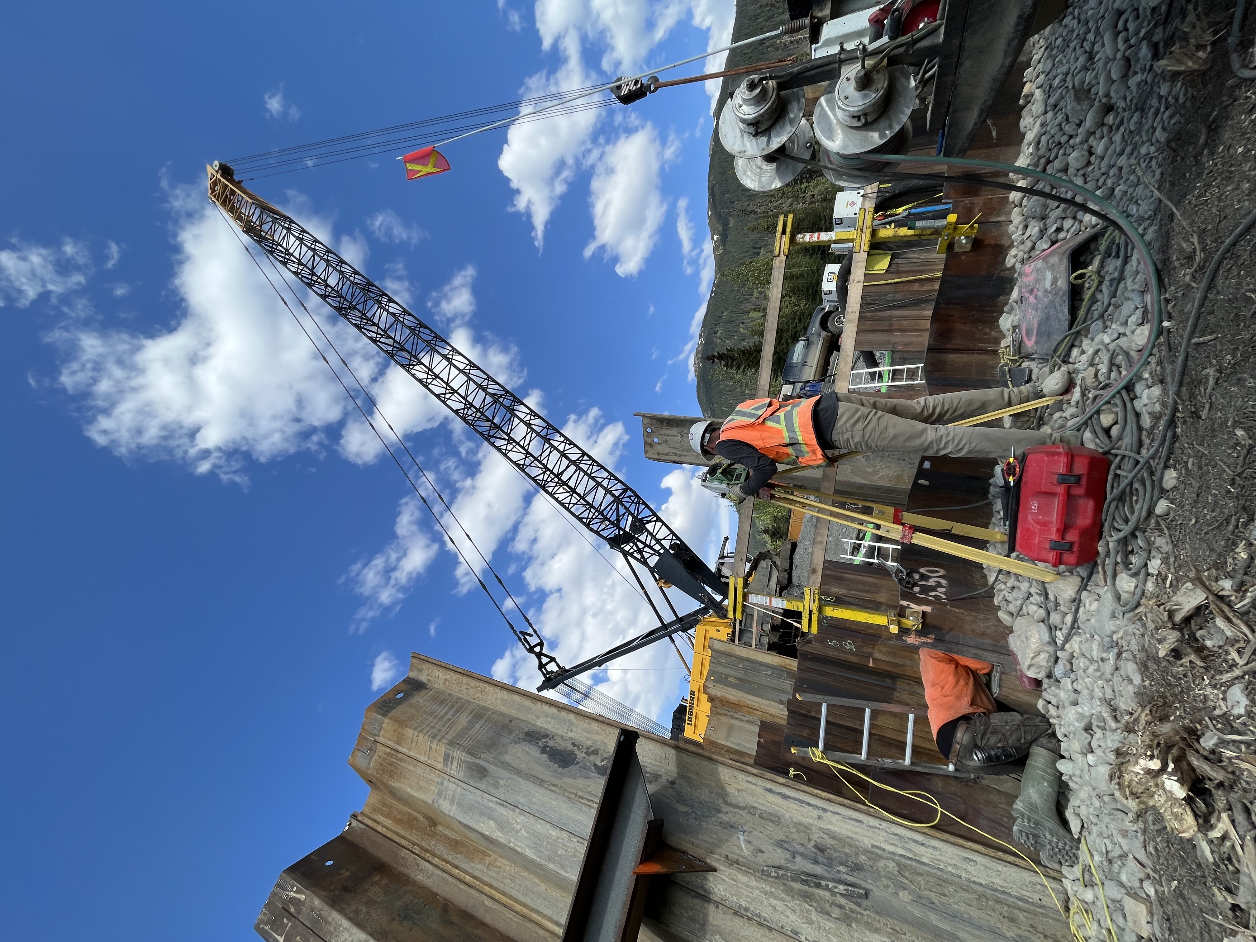
- Deep as-built expertise: Extensive record of acceptance surveys on bridges, plants, municipal utilities, and transportation structures — delivered on tight timelines and in live facilities.
- Tight-tolerance verification: Anchor bolts, embedded plates, rails, pipe inverts, slabs, and finished grades checked against design with documented control and independent check shots.
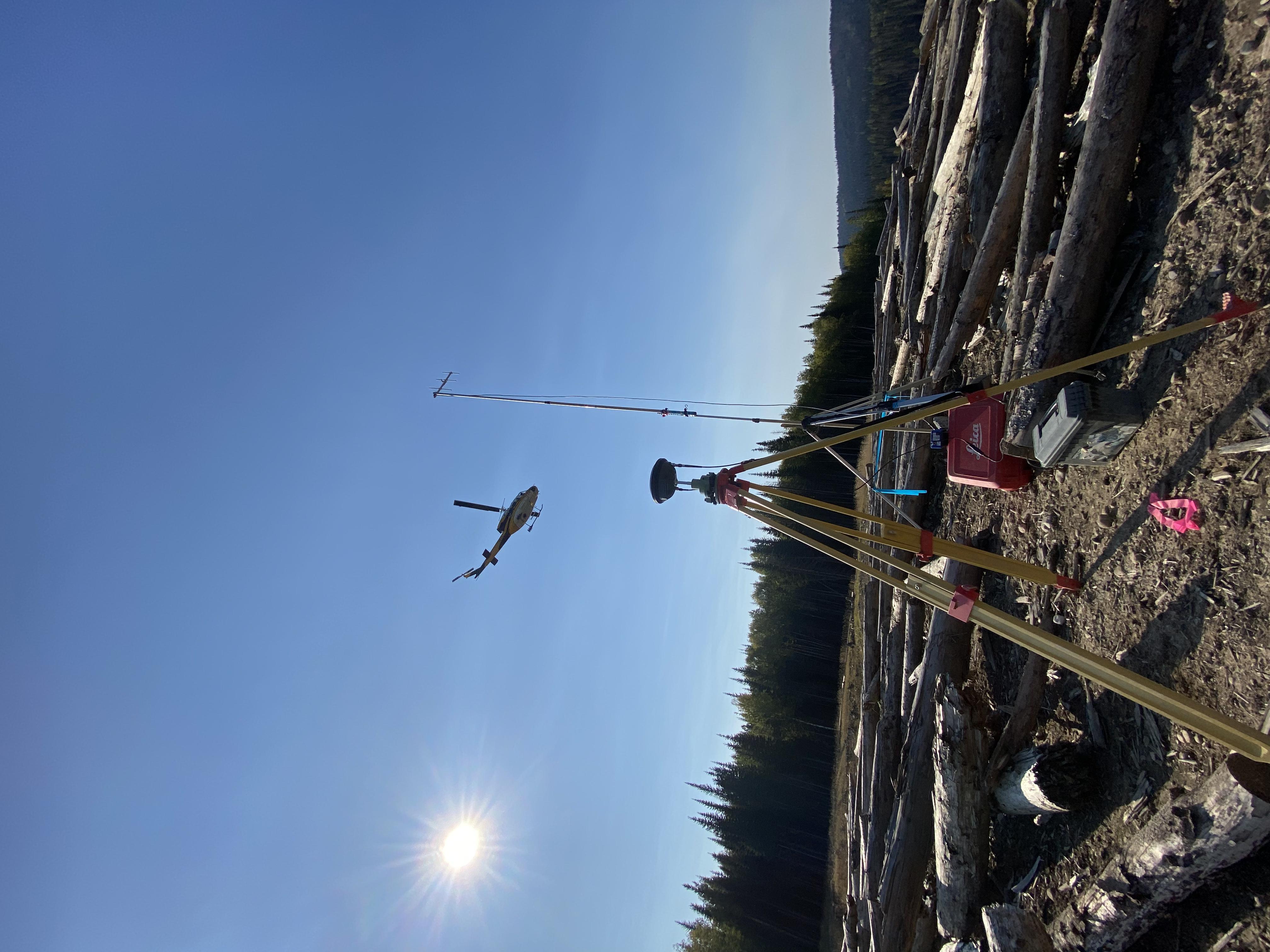
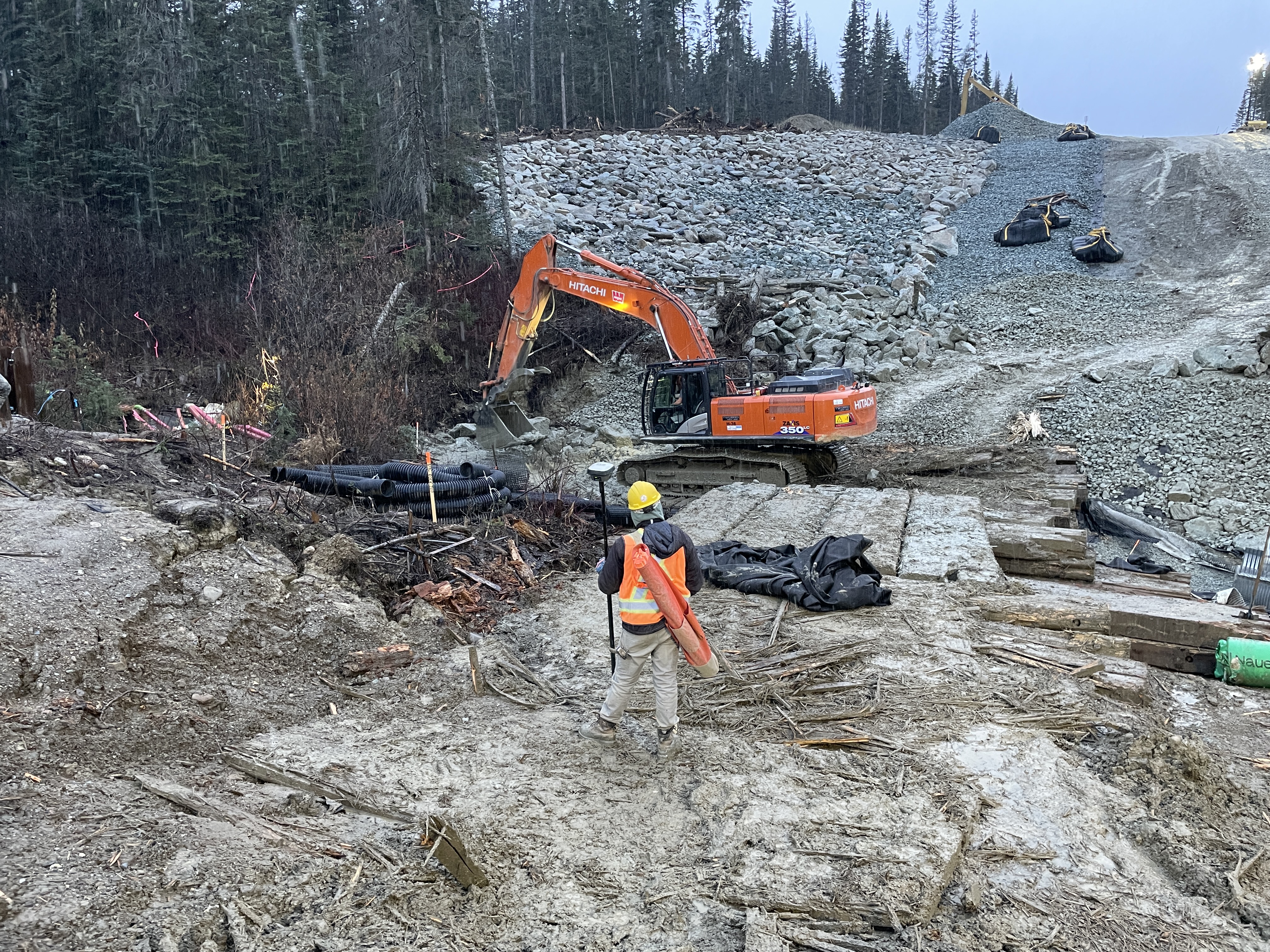
- Methods matched to complexity: Robotic total stations for precision stake/measure and SLAM for dense geometry, reflectorless shots where access is constrained.
- Defensible deliverables: Layered DWG/DXF built to your templates, comparison heatmaps and deviation tables, photo-referenced notes, and a clear QA/QC sign-off packet.
- Challenging environments: Traffic control, confined-space procedures, night work, shutdown coordination, and GNSS-challenged sites handled safely and efficiently.
*Per project specification, access constraints, and control quality.
Deliverables
 CAD Packages
- Layered DWG/DXF with linework, blocks, and annotation
- TIN surfaces, breaklines, and contours (0.25–1.0 m)
- Title blocks, legends, and sheet sets (optional)
 Surfaces & Points
- DTM/DSM rasters and hillshade (GeoTIFF)
- Classified point clouds (LAS/LAZ)
- Feature-coded survey points (CSV/SHP)
 Formats
Workflow
- Scope & standards (layers, symbology, tolerances, datums)
- Control (GNSS/total station, benchmarks, check shots)
- Acquisition (terrestrial/UAV/mobile LiDAR + conventional shots)
- Processing (classification, breaklines, surface modeling)
- Compilation (feature coding, linework, attribution)
- Packaging (CAD/GIS deliverables and map sheets)
- QA/QC (residuals, RMSE, coverage, completeness)
Features Mapped
Surface & Grading
- Ground, pavement, curbs/gutters, sidewalks
- Breaklines at edges and grade changes
- Contours and spot elevations
 Utilities & Sites
- Valves, manholes, inlets, hydrants, poles
- Fences, walls, signs, guardrails, lighting
- Building footprints and key as-built details
Structures
- Headwalls, culverts, bridges/abutments
- Foundations, slabs, pads, anchors
- As-built alignment and geometry checks
 As-Built Services
- Acceptance surveys on bridges, plants, and municipal works
- Critical features: bolts, embeds, rails, inverts, slabs, grades
- Verification: robotic TS with TLS/SLAM scan control
- Tolerance checks & independent QA; deviation heatmaps/tables
- Deliverables: layered DWG/DXF with redlines & photo docs
Technology
 Survey Instrumentation
- GNSS RTK/PPK, robotic total stations
- Digital levels for benchmarks
- Reflectorless shots for inaccessible features
Scanning
- Mobile LiDAR (vehicle-mounted) for corridors and roads
- UAV LiDAR for rapid site coverage
- SLAM for GNSS-challenged areas