
Overview
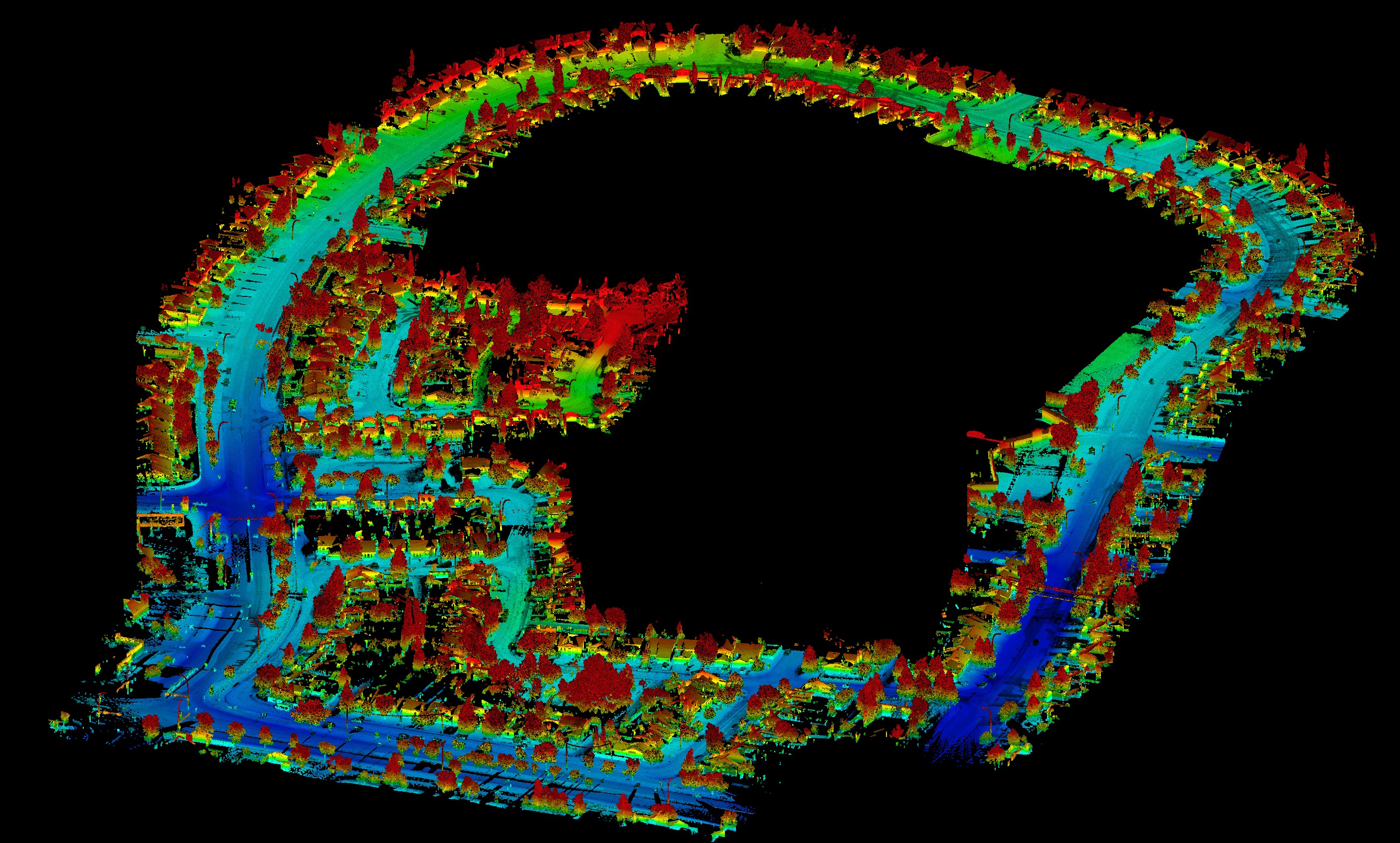
Convex Geomatics Ltd. delivers fast, safe mobile mapping by combining vehicle-mounted LiDAR, 360° panoramic imaging, backpack-mounted LiDAR and handheld SLAM LiDAR. We capture dense, georeferenced 3D at highway speeds and continue seamlessly into GPS-denied interiors such as tunnels, plants, and parkades - producing datasets that drop cleanly into engineering design, asset inventories, and digital twin programs.
Speed & safety first. Working from the roadway means fewer lane closures and less field exposure. Our vehicles cover long corridors efficiently while SLAM crews handle tight or obstructed spaces, so your network is mapped with minimal disruption.
Defensible accuracy. GNSS/IMU trajectories, survey control integration, and SLAM optimization deliver centimetre-level results you can trust. Continuous checks and transparent QA/QC make the data approval-ready for owners and consultants alike.
Rich, review-ready content. We provide full-coverage point clouds and colorized 3D with synchronized 360° imagery for rapid feature confirmation. Curb lines, lane markings, signage, utilities, bridges, and clearances are captured in one pass, giving teams a shared visual record for decisions and design.
Fusion when it matters. Need rooftops, bridge decks, or cliff faces? We can merge UAV and terrestrial scans with mobile LiDAR to fill occlusions and complete the vertical picture - aligned to your project control, datum, and CAD/GIS standards.
Tell us what you need measured and to what tolerance. We'll recommend the most efficient mix of vehicle, backpack, SLAM, and UAV to meet your schedule and budget, and deliver clean, documented data that's ready for design and asset management.
Applications
 Transportation
- Road & rail corridors
- Clearance, encroachment & deformation
- Bridge, tunnel & overpass documentation
- Signage, guardrail & pavement assets
 Urban & Utilities
- Street-level digital twins
- Utility & right-of-way mapping
- Municipal inventory & condition
- Construction as-built and monitoring
 Interiors (SLAM)
- Facilities & plants, GPS-denied areas
- Historic structures & BIM baselines
- Floor plans & egress mapping
- Clash detection pre-design
Platforms
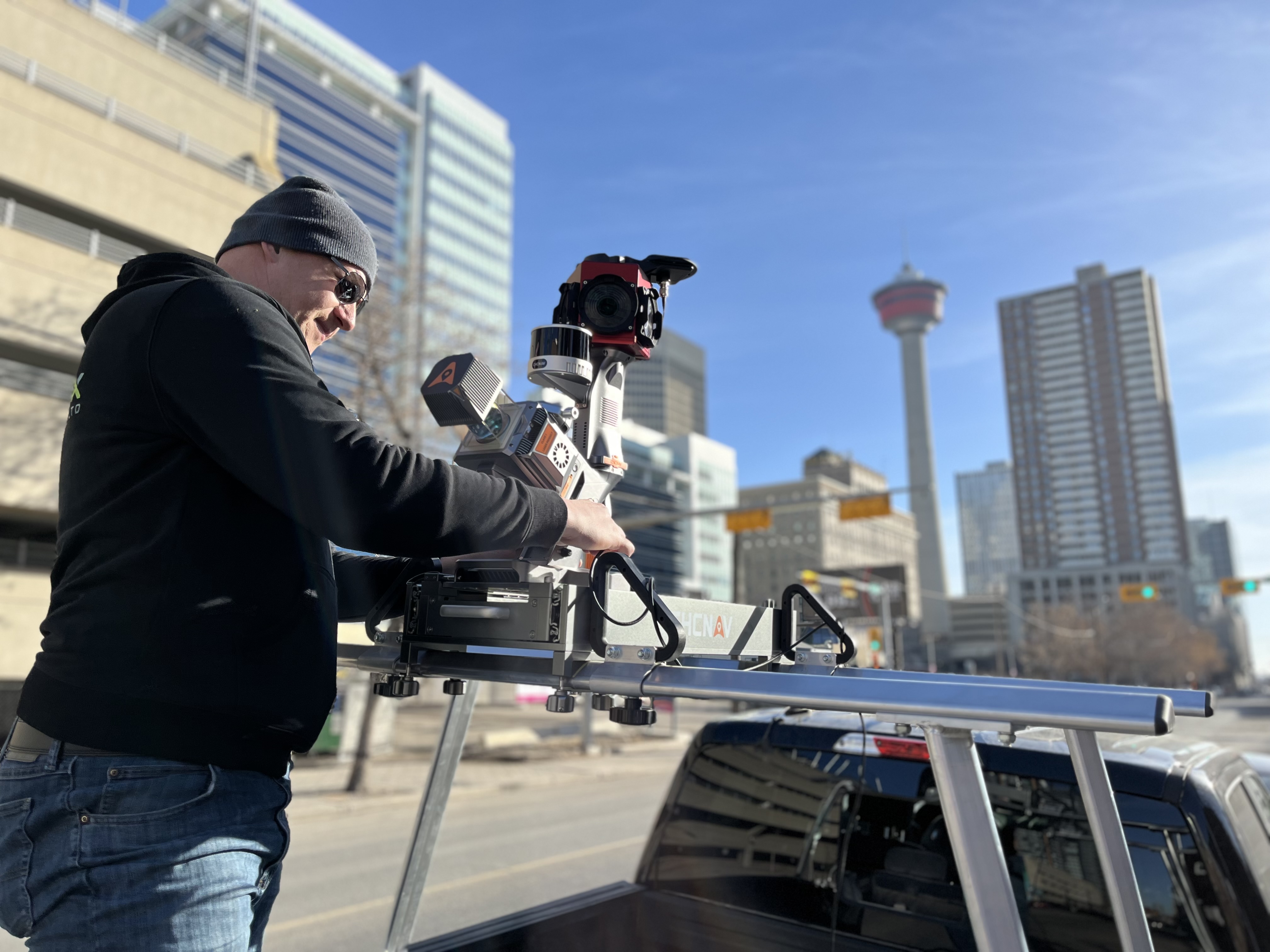
 Vehicle-Mounted
- Multiple scanners for 360° coverage
- GNSS/IMU trajectory & control integration
- HD panoramic imaging
- Rapid corridor acquisition
UAV Integration
- Data fusion for occlusions & verticals
- Comprehensive site coverage
- Consistent datums & projections
- Unified deliverables
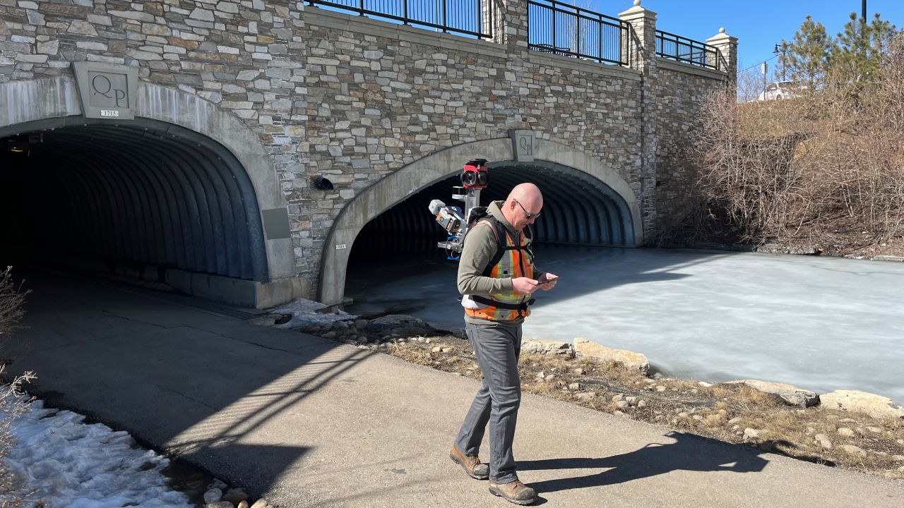
 Handheld SLAM
- Indoor & GNSS-denied capture (buildings, plants, tunnels).
- Rapid as-builts, floor plans & volume checks.
- Lightweight for tight/complex spaces.
- Real-time SLAM with loop-closure; aligns to site control.
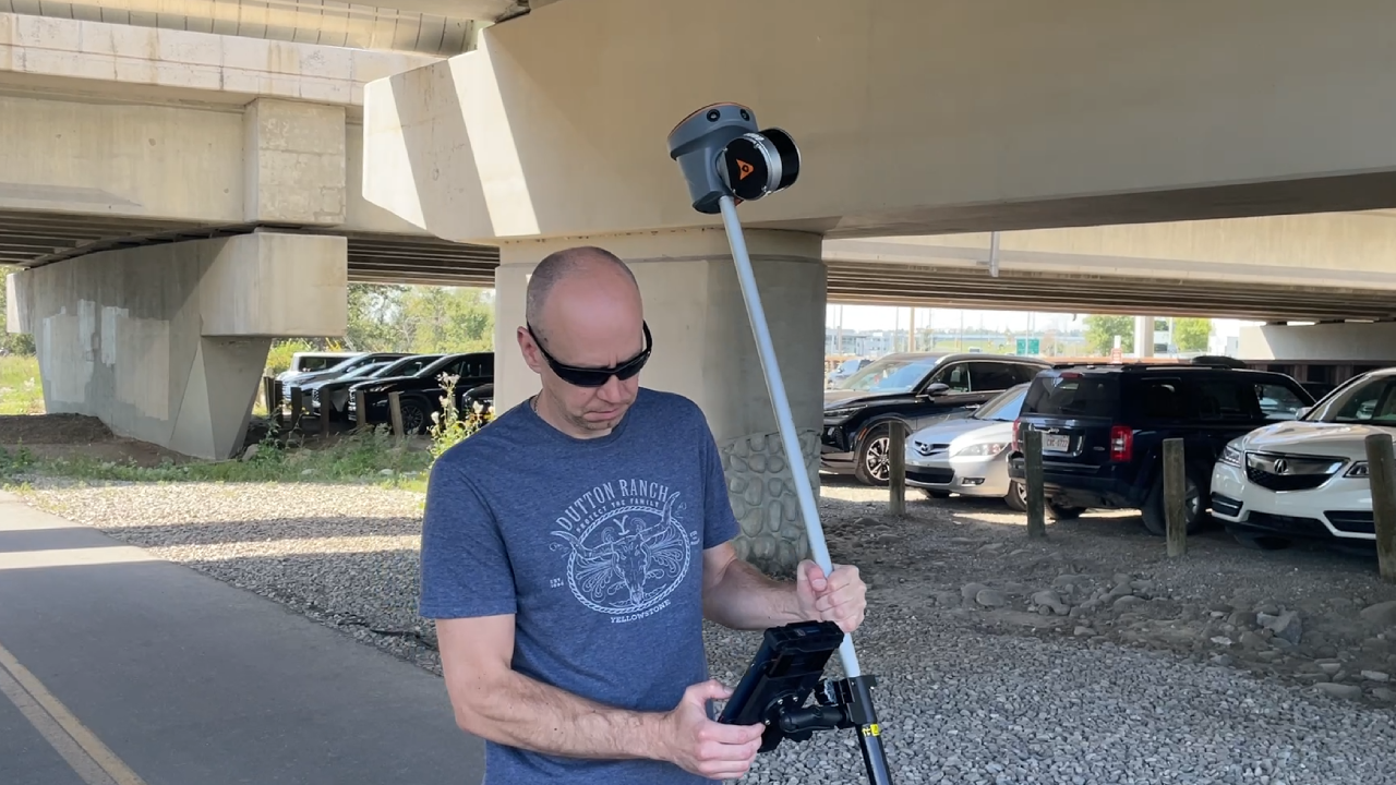
 Backpack LiDAR
- No-fly / no-vehicle corridors (parks, trails, pathways).
- High-detail under canopy with minimal disturbance.
- Long-path SLAM with loop-closure; ties to control.
- Fuses with vehicle/UAV data for complete coverage.
Deliverables
 Core Outputs
- Classified point clouds (LAS/LAZ)
- Colorized points & 3D models
- Trajectory & metadata
- 360° imagery (optional)
 Processed Data
- Vectorized features
- Clearances, cross-sections & profiles
- Feature extraction & asset inventory
- Change detection / condition