
Overview
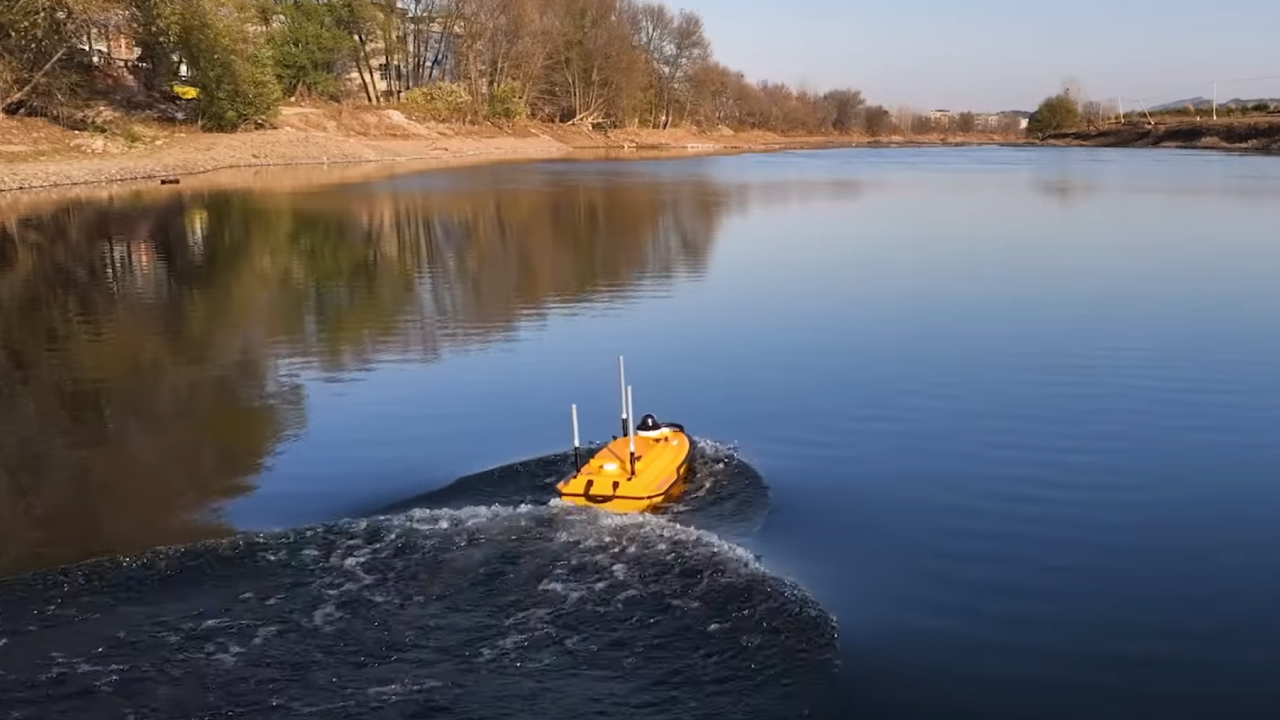
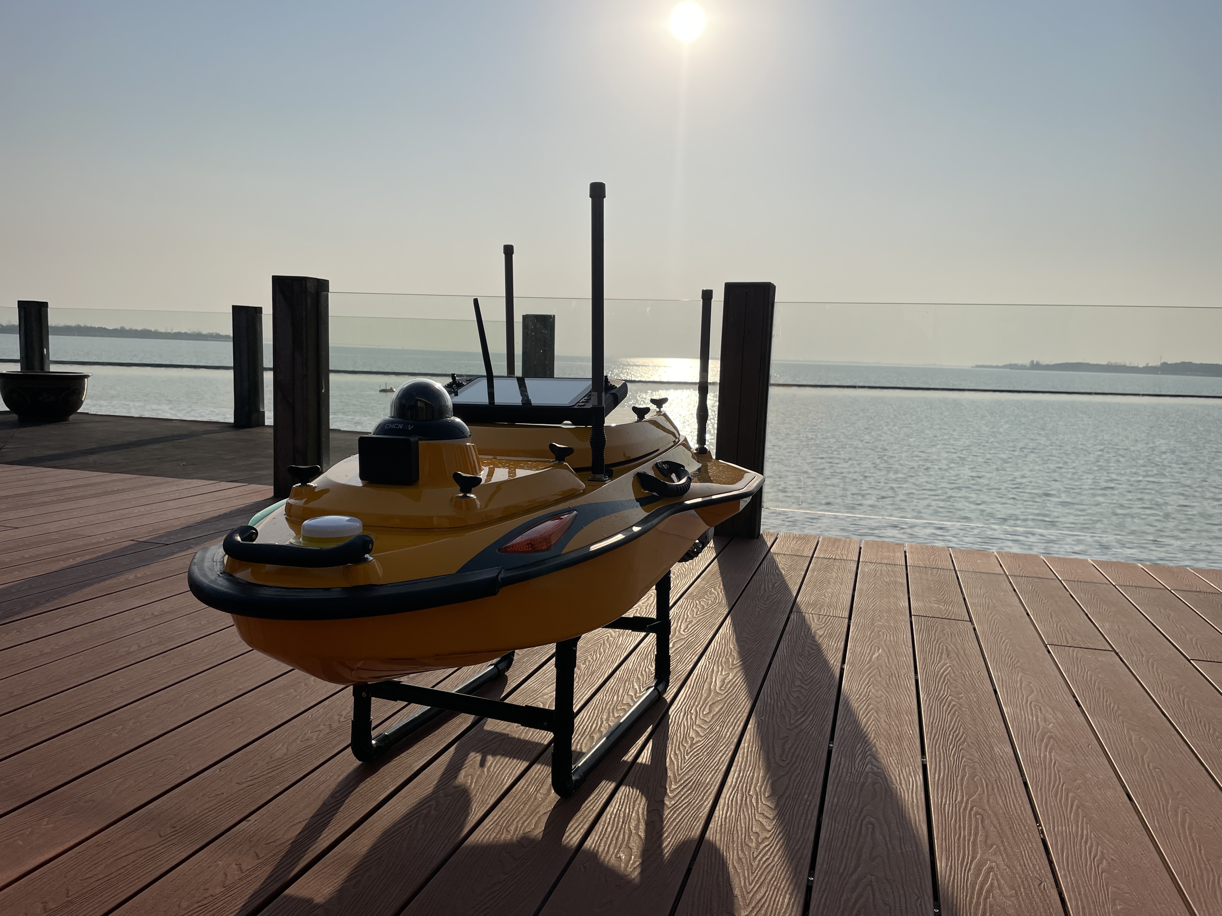
We perform survey-grade hydrographic and bathymetric mapping with a single-beam echo sounder (SBES) on an unmanned surface vessel (USV), safely capturing reliable depths in rivers, canals, reservoirs, storm ponds, harbours, and around bridges and intakes. The USV keeps crews off the water, works close to edges with minimal wake, and launches from tight access points — ideal for busy worksites and sensitive habitats. Where conditions allow, the system maps to 200 m depth and can be combined with aerial or terrestrial LiDAR to produce a seamless topo-bathymetric surface. For deeper context on bathymetric methods and sensor selection, see our Bathymetric Methods in Surveying article.
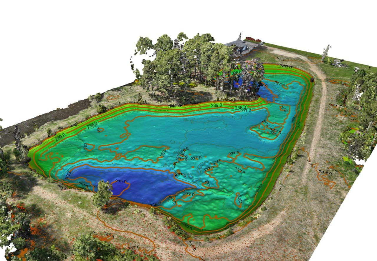
Deliverables include clean soundings, bathymetric terrain and contours, and cross-sections packaged for CAD/GIS to support engineering, dredging, and asset management.
*Depends on environment, sound-velocity stability, and control quality.
Conventional vs Manned Boat vs USV Bathymetric Methods
Choosing the right deployment method for the water body, access, and safety profile of your project.
| Capability | Conventional (wading / staff) | Manned Boat | USV (ours) |
|---|---|---|---|
| Operator safety | Shore / wading | Crew on board | Remote & safe |
| Hazardous water (currents, ice, contamination) | High risk | Moderate risk | Low risk |
| Shallow water access | Excellent (where wadable) | Limited | Excellent |
| Coverage rate | Slow | Fast | Fast |
| Mobilization & launch | Minimal | Trailer & ramp required | Single vehicle |
| Crew size | 2–3+ | 2–3+ | 1–2 |
| Accuracy | ±5–15 cm | ±5–10 cm | ±5–10 cm |
| Best fit for | Spot soundings, very shallow | Large lakes, deep open water | Any water body — shallow, deep, hazardous or confined |
For workflow detail: Bathymetric Methods in Surveying.
See real deliverables
Open our Sample Data Portal — preview orthophotos, point clouds & 3D tiles in your browser.
River Crossing Bathymetric Survey
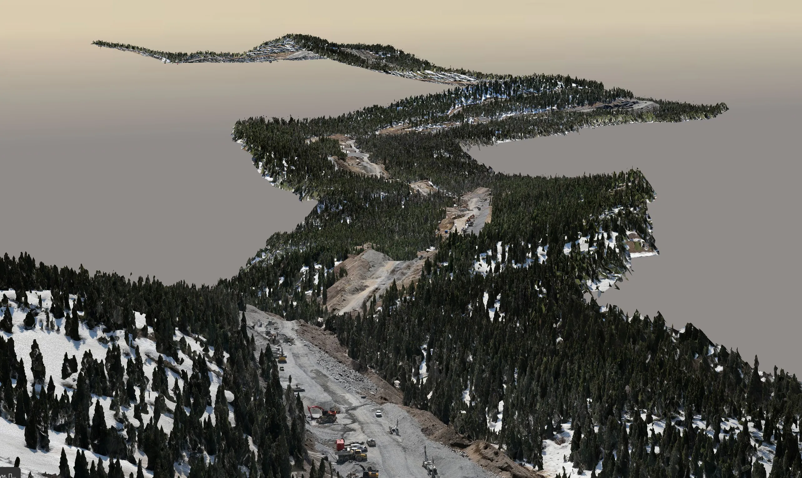
Single-beam bathymetric survey of a pipeline river crossing — merged with above-water LiDAR to produce continuous terrain.
View all projectsWhy Choose Convex Geomatics for Bathymetric Surveys in Alberta
- Calgary-based team with deep local knowledge of Alberta waterways and regulations
- USV technology for safer, faster, and more environmentally friendly surveys
- Seamless integration with our UAV LiDAR and topographic surveying services
- Engineering-grade deliverables tailored for consultants, municipalities, and energy clients
- Proven workflows with full QA/QC documentation and vertical datum control
Bathymetric Surveys for Alberta's Key Industries
Stormwater Ponds & Reservoirs
- Bathymetric mapping for sediment accumulation and storage capacity analysis ↗
- Sludge thickness assessments and dredging support surveys
- Condition monitoring for municipal ponds and reservoirs
Rivers & Flood Studies
- River cross-sections, thalweg profiling, and hydraulic model support
- Floodplain, channel morphology, and erosion monitoring surveys
- Integrated topo-bathymetric data for engineering and flood studies
Mining & Environmental
- Tailings ponds, settling ponds, and mine water bathymetry
- Sediment characterization and environmental monitoring
- Volume calculations and compliance support surveys
Dams, Canals & Infrastructure
- Bathymetric surveys for dams, intakes, canals and culvert systems
- Scour assessment around hydraulic structures and bridge crossings
- Inspection support using USV, sonar and hydrographic sensors
Deliverables
 Core Outputs
- Soundings (XYZ/CSV) with QA codes
- Bathymetric DTM/DSM (GeoTIFF) with hillshade
- Contours (0.25–1.0 m)
- Sediment surface and hard-bottom models from dual-frequency echo sounding
- Sediment thickness models and sludge thickness heatmaps
 Engineering Products
- Cross-sections, profiles, alignment sheets
- Scour, siltation and volume change assessments
- Sediment layer analysis using high/low frequency acoustic returns
- Sediment surface and hard-bottom models, sediment thickness volume calculations
- Sediment thickness heatmaps and contours
- Shoreline & structure mapping (bridges, intakes, outfalls)
 Formats
Workflow
- Planning & permits, safety, datum/level strategy
- Calibration: patch test, bar-check, latency/motion checks
- Acquisition: SBES lines, overlaps, shoreline tie-ins
- Corrections: tide/RTK water-level, SVP/refraction, heave
- Cleaning: automated filters & manual QA
- Gridding & modeling: DTMs, contours, sections
- QA/QC & reporting: check lines, statistics, coverage
- Delivery: CAD/GIS packages & documentation
Technology
 Sonar & Sensors
- Single-beam echo sounder (SBES)
- Dual-frequency echo sounders for sediment thickness and sludge layer detection
- Optional multibeam and ADCP payload integration
- IMU for heave, pitch, roll, and yaw compensation
Positioning
- RTK/PPK GNSS with local control
- RTK water level and elevation corrections
- Chart and project vertical datums
- Integrated topo-bathymetric survey workflows