
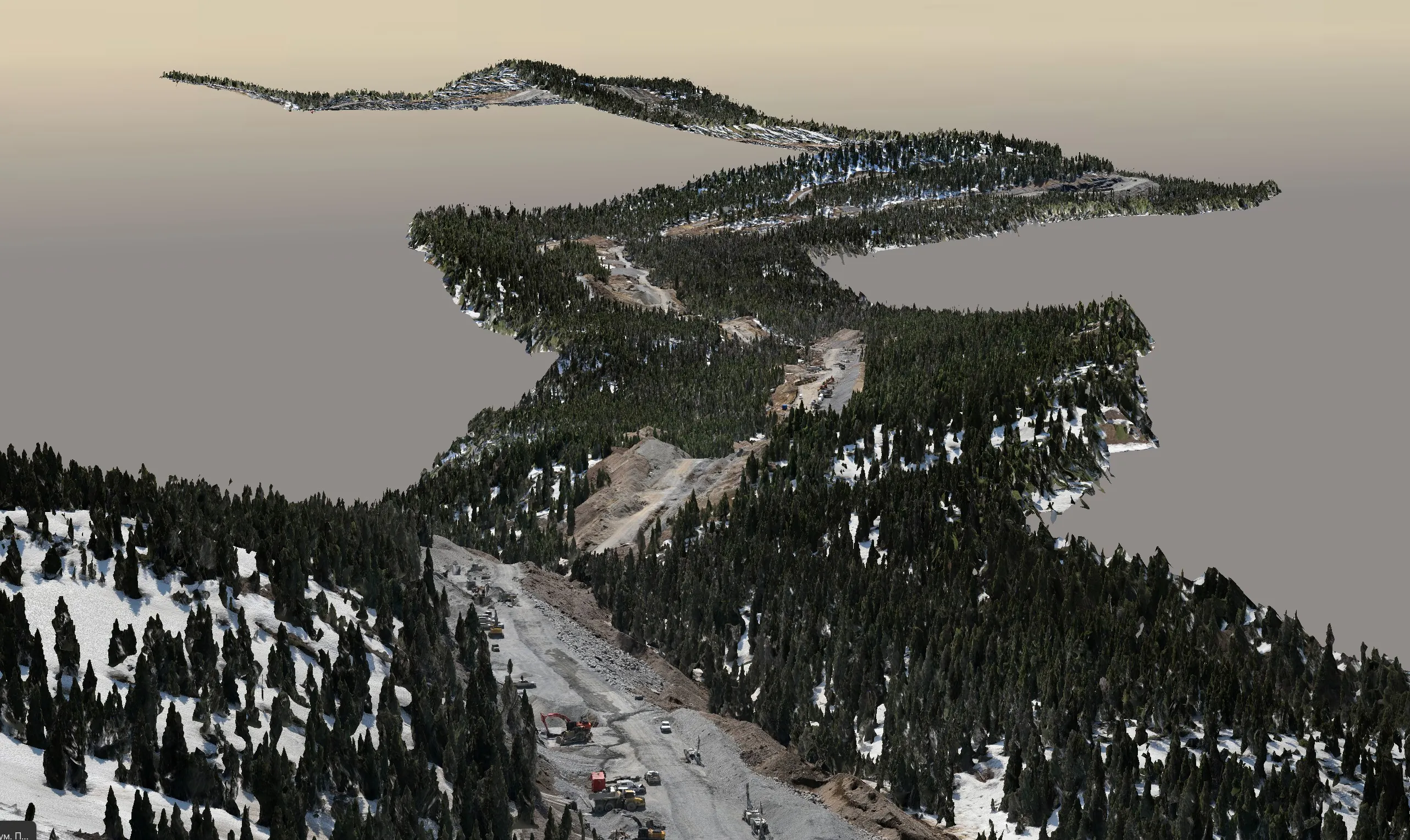
Every few weeks someone calls us and asks a version of the same question: “Is there LiDAR data for my site in Alberta, and can I just use that?” The honest answer is sometimes. Alberta has several genuinely useful open LiDAR programs, and for the right job they save real money. But they are also misunderstood — people assume “LiDAR” means “survey grade,” and it often does not.
This guide lists the public sources we actually use, explains what each is good for, and gives a plain checklist for deciding when to commission a fresh flight instead.
Rule of thumb: if the deliverable will be used for design, quantities, acceptance, or anything with a stamp on it, public LiDAR is your context layer — not your survey.
Where to Get Free LiDAR Data in Alberta
These are the sources worth checking, in the order we check them.
| Source | What you get | Coverage | Licence |
|---|---|---|---|
| Open Data Areas Alberta (ODAA) opendataareas.ca |
Provincial LiDAR point clouds and derived DEMs for selected regions | Named areas only — e.g. Fort McMurray, Fox Creek, Taber, Beaver Hills, Utikuma Lake, Rocky Mountain House–Sylvan Lake | ODAA data user licence, no cost |
| NRCan — LiDAR Point Clouds (CanElevation Series) open.canada.ca / AWS Open Data |
Classified point clouds as Cloud-Optimized LAZ (COPC), organized by acquisition project; derived DTM/DSM also published | Growing patchwork of federal and partner projects across Alberta; check the project index map | Open Government Licence – Canada |
| City of Edmonton Open Data data.edmonton.ca |
2025 LiDAR: bare-earth and full-feature point clouds, city-wide (about 860 km², flown June 2025) | Entire city plus a 100 m buffer | City of Edmonton open data licence |
| City of Calgary data.calgary.ca / City Online |
Ongoing LiDAR program since 2022 (1,175+ km²); 2 m DEM open, 1 m DEM and point-cloud products licensed | City and surrounding rural areas | Mixed — open for 2 m DEM, data agreement for the rest |
| Alberta Open Government / AltaLIS open.alberta.ca, altalis.com |
Provincial DEMs (largely photogrammetric or 20K-derived, not LiDAR in most areas), base mapping, township fabric | Province-wide | Alberta Open Government Licence |
Two practical notes. First, coverage maps change — new NRCan and municipal projects are added every year, so re-check even if you looked six months ago. Second, “LiDAR available” on a portal often means a derived DEM, not the point cloud. If you need the cloud (for classification, vegetation, structures, or your own surface build), confirm the raw LAS/LAZ is actually downloadable.
What Public LiDAR Is Genuinely Good For
We use open LiDAR constantly. It is the right tool for:
- Desktop feasibility and route studies — slope, drainage, cut/fill order-of-magnitude, access planning.
- Hydrology and flood modelling — regional bare-earth surfaces are exactly what watershed models want.
- Context around a survey — we routinely merge a fresh UAV LiDAR site with public LiDAR for the surrounding kilometres so engineers see the whole picture.
- Flight planning — terrain-following UAV missions and obstacle checks.
- Change detection baselines — comparing a new survey against the last public flight shows what moved.
- Vegetation and forestry screening — canopy height and density at a landscape scale (see our forestry LiDAR article).
Where It Falls Short
The limitations are not about quality — the public programs are well run. They are about fit.
- Age. A dataset flown in 2019 does not show the 2024 stockpile, the new lift of fill, or the culvert that washed out. Any active site is out of date the week after it is flown.
- Density. Regional programs commonly deliver a few points per square metre. A UAV LiDAR flight delivers hundreds. That difference is a curb, a pipe, a bench edge, or a breakline you can actually see.
- Accuracy and control. Public data is adjusted to a provincial or national datum, not to your project’s control monuments. Decimetre-level vertical accuracy is normal for regional data; it is not adequate for grading design, pay quantities or as-builts.
- Season. Leaf-on flights leave gaps under canopy. You do not get to choose.
- Classification. Ground/non-ground is usually good; buildings, wires, water and vegetation classes vary widely by program.
- Licence. Open licences generally allow reuse with attribution; licensed municipal data may have restrictions on redistribution to your client or embedding in a deliverable — check the terms.
- Scope. Public datasets are produced for their program’s purpose, not for your project. Whether they are suitable for a specific engineering use is a decision your project team has to make.
Density in practice: at 4 pts/m² a 1 m wide ditch is about 4 points across; at 300 pts/m² it is about 300. The first is enough to see the ditch exists; the second is enough to profile it.
When You Need to Fly Your Own
Use this table as a quick screen. If your project sits in the right-hand column, budget for a dedicated capture.
| Need | Public LiDAR usually fine | Commission a survey |
|---|---|---|
| Accuracy | ±15–50 cm acceptable | ±2–5 cm tied to site control |
| Currency | Terrain unchanged for years | Active site, recent construction, disturbance |
| Detail | Landscape slopes, drainage | Curbs, pipes, breaklines, structures, benches |
| Vegetation | Canopy metrics | Bare earth under dense brush, leaf-off timing |
| Purpose | Feasibility, modelling, context | Design, volumes, as-builts, monitoring, legal |
| Reuse | Internal analysis | Deliverable you must redistribute or certify |
Typical projects that end up in the right column: stockpile and earthwork volumes, pre-design topographic and as-built surveys, construction monitoring, pipeline and road corridors that need a current, dense strip (mobile LiDAR or UAV LiDAR), and anything with water in it, where public LiDAR stops at the surface and a bathymetric survey is required.
The Smart Approach: Combine Both
The most cost-effective projects we deliver use public LiDAR for everything it is good at and a targeted flight for everything it is not. A typical corridor job looks like this:
- Pull NRCan or provincial LiDAR for a 2–5 km buffer — hydrology, access, context, free.
- Fly the actual right-of-way and work areas with UAV LiDAR at 200–400 pts/m², tied to project control, leaf-off if vegetation matters.
- Merge both on one datum, document the seam, and deliver a single surface with an accuracy statement for each zone.
The client gets engineering-grade data where it matters and pays only for the area that needs it.
How to Download and Check a Public Dataset
- Find the tile or project on the portal’s index map. Note the acquisition date — it is usually in the metadata, not the file name.
- Download the point cloud (LAS/LAZ/COPC), not just the DEM, if you plan to build your own surface.
- Read the metadata for datum (NAD83 CSRS, epoch), vertical reference (CGVD2013 vs CGVD28), point density, and stated accuracy.
- Spot-check against any known elevations you have on site. A handful of GNSS points tells you immediately whether the data is usable for your purpose.
- Record the licence and attribution you will need in the deliverable.
If any step is unclear, you are welcome to send us the site location and we can take a look at what public data exists for it.
FAQ
Is there free LiDAR data for Alberta?
Yes, for some areas: ODAA regional datasets, NRCan’s CanElevation point clouds, and the City of Edmonton’s 2025 city-wide LiDAR. Coverage is not province-wide.
Does Calgary have open LiDAR?
Partly. A 2 m DEM is open; 1 m DEMs and point-cloud products from the City’s LiDAR program are licensed under a data agreement.
How accurate is it?
Regional data is typically decimetre-level vertically at a few points per square metre; recent municipal programs are closer to 5–10 cm. Neither is tied to your project control.
When do I need my own survey?
Changed sites, centimetre accuracy, engineering detail, bare earth under vegetation, volumes, as-builts, monitoring, or a dataset you must redistribute or certify.
Not sure if public LiDAR covers your site?
Send us the location and what you are trying to do with the data. We are happy to discuss whether public sources or a dedicated capture fits the project.