
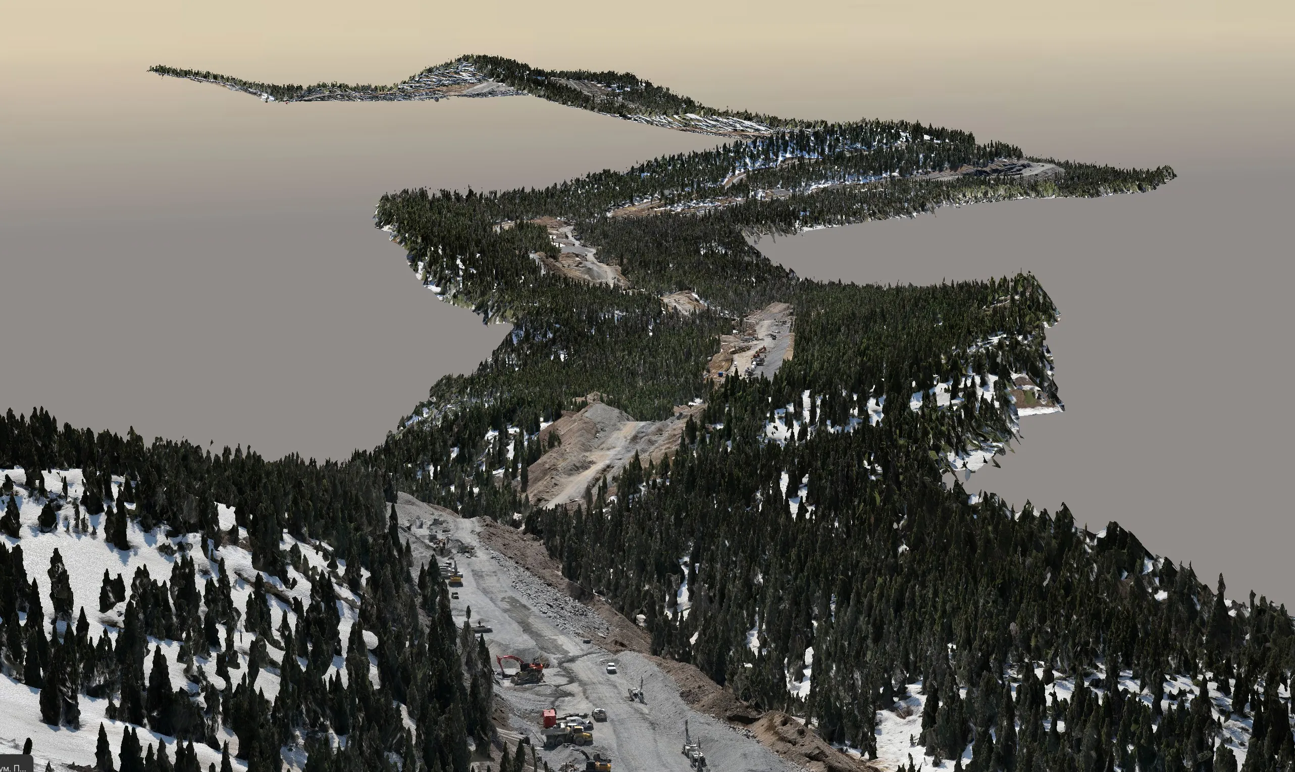
Engineering Surveying for the Edmonton Region
Convex Geomatics is a Calgary-based geomatics firm that works across Alberta, and the Edmonton Metropolitan Region is one of our most frequent destinations. We bring the same sensors and workflows we use on Calgary projects — UAV and mobile LiDAR, photogrammetry, GNSS/RTK control, robotic total stations and single-beam bathymetry — to sites from Leduc and Nisku in the south to Fort Saskatchewan and the Industrial Heartland in the northeast.
Because we are not tied to a single method, we match the capture technique to the job: mobile LiDAR for long road and utility corridors, UAV LiDAR for vegetated or hard-to-access parcels, terrestrial scanning for buildings and plants, and conventional instruments where millimetre accuracy is the requirement. Every deliverable is tied to site control and ships with a QA summary so your engineers can rely on it without re-checking.
Survey Services We Deliver in Edmonton
 Mobile Mapping & Corridor Surveys
- Vehicle-mounted LiDAR for roads, ring road segments, rail and utility corridors
- Pavement, curb, signage and overhead-line inventories without lane closures
- Design-ready DWG/LandXML and classified point clouds
 Topographic & As-Built Surveys
- Pre-design topo for subdivisions, industrial lots and municipal projects
- As-built and record surveys for acceptance and asset registers
- Contours, DTM/DSM, feature codes to your CAD standard
 UAV & Aerial LiDAR
- Vegetation-penetrating LiDAR for river valley, ravine and treed parcels
- Large-area mapping for land development and environmental studies
- Advanced RPAS operations in controlled airspace
 Volumetric & Stockpile Surveys
- Gravel pits and aggregate yards around the Capital Region
- Cut/fill and earthwork progress for site grading
- Reconciliation-ready reports, ±1–3% stockpile accuracy
 Bathymetric Surveys
- Stormwater ponds, lagoons and reservoirs — capacity and dredge volumes
- River and creek crossings for pipelines and bridges
- Merged above/below-water surfaces on one datum
 Construction Layout & Monitoring
- Layout, grade checks and quantity verification
- Deformation and settlement monitoring for structures and excavations
- Millimetre-level control with robotic total stations
 3D Scanning & Measured Building Surveys
- Terrestrial and handheld LiDAR for buildings, plants and heritage structures
- Floor plans, elevations, sections and BIM-ready point clouds
- Interactive web 3D viewers for stakeholders
 LiDAR Processing & Deliverables
- Classification, feature extraction and surface modelling
- Orthophotos, meshes, digital twins
- Formats: DWG/DXF, LandXML, LAS/LAZ, GeoTIFF, SHP/GDB
Areas We Cover Around Edmonton
City of Edmonton and the full Edmonton Metropolitan Region, including:
Edmonton is also our staging point for work further north and east — Fort McMurray, Cold Lake, Bonnyville, Lloydminster, Slave Lake and the Peace Region. If you have sites in more than one of these areas, tell us and we will look at scheduling them on one mobilization.
How a Project Runs When You’re in Edmonton and We’re in Calgary
- Scope by phone or email — send the site location, area or corridor length, deliverables and deadline. We return a quote with mobilization included.
- Permits & control — we handle RPAS airspace authorizations, coordinate site access, and establish or tie into your control network.
- Field capture — capture time depends on site size and access. Scheduling is planned around your dates and site conditions.
- Processing & QA — classification, surface build, feature extraction, check-point residuals and a QA summary.
- Delivery — CAD/GIS packages, reports, and a browser-based 3D viewer for your team. Signed plans where required.
Why LiDAR and Mobile Mapping Make Sense in the Edmonton Region
River valley & ravines
The North Saskatchewan valley and its ravines are steep and treed. UAV LiDAR penetrates canopy to map bare earth safely, where ground crews and photogrammetry struggle.
Long corridors
Anthony Henday, arterial roads, rail and pipeline rights-of-way are mapped faster and more safely from a moving vehicle than on foot — with no lane closures.
Short seasons
Leaf-off windows in spring and fall are ideal for LiDAR. We plan captures around them so vegetated sites get the best ground definition.
Industrial & plant sites
Refineries, upgraders and fabrication yards in the Heartland and Nisku benefit from scan-to-BIM point clouds and digital twins for brownfield design.
Edmonton Surveying FAQ
Have a site in the Edmonton region?
Send the location and what you need — we’ll scope it and quote with mobilization included.
 Request a Quote