How We Capture It
Two synchronized capture methods, one mobilization, one fused dataset.
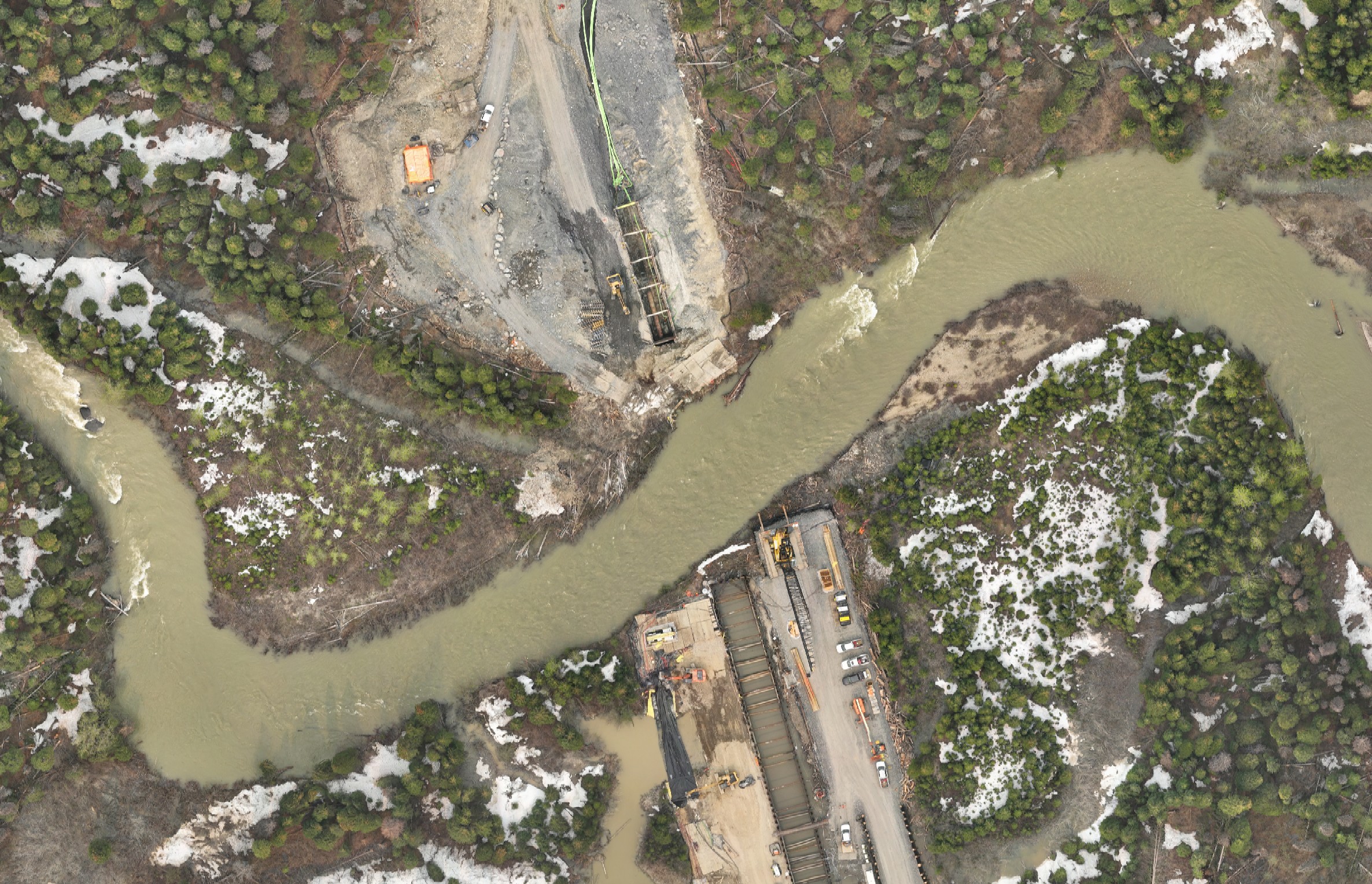
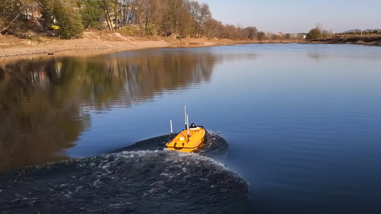
USV Bathymetry for the Channel
An unmanned surface vessel with single-beam echo sounder and RTK GNSS captures the river bottom on planned line spacing. The USV operates safely in fast currents and remote crossings where putting a boat crew at risk is not acceptable. We collect dense soundings across the full channel and overlap the shoreline transition zone with UAV LiDAR so the fused TIN has no gap at the waterline.
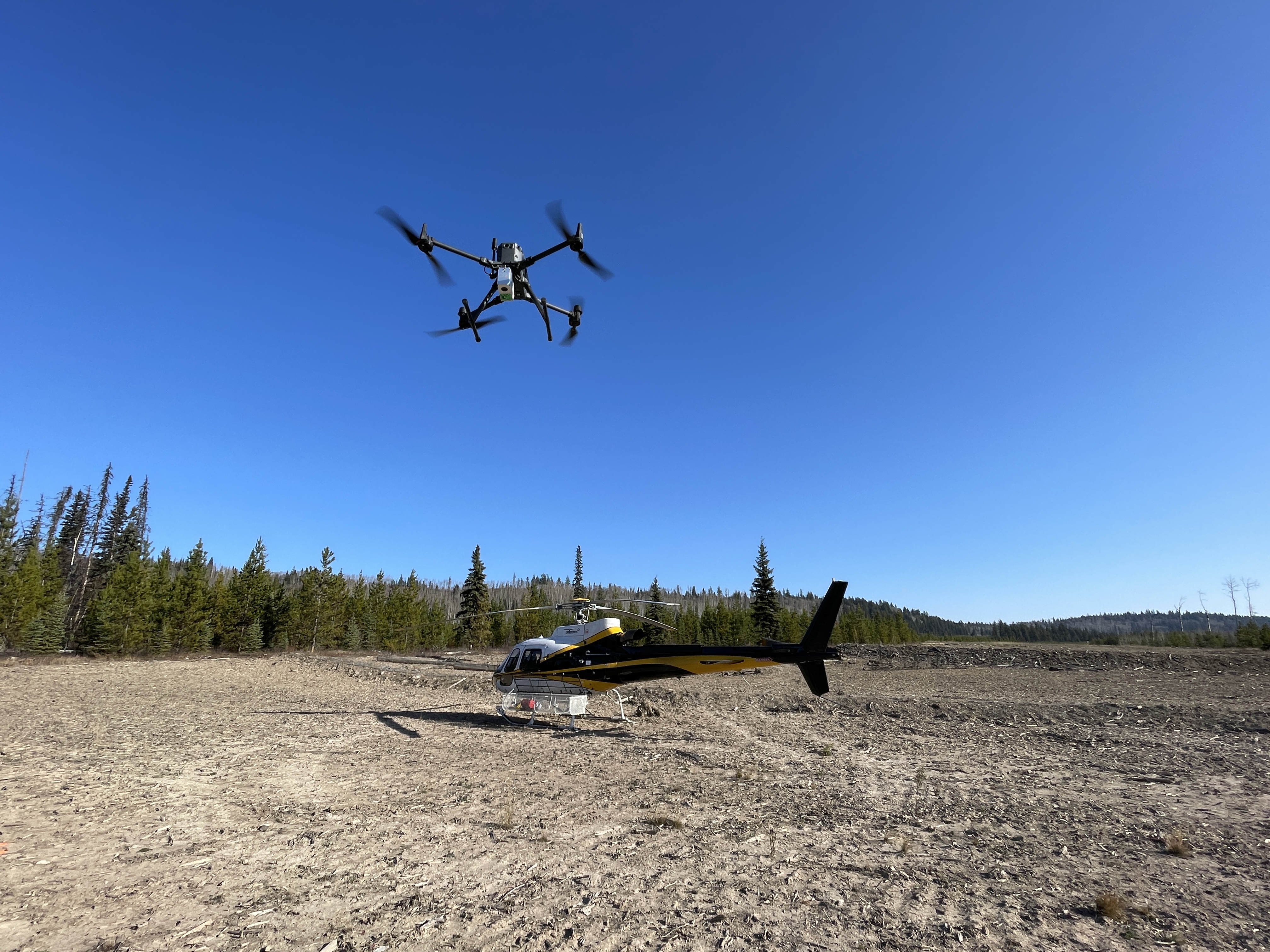
UAV LiDAR for Bank Topography
A drone-mounted LiDAR captures bank topography, riparian vegetation, approach grades, and access roads at typical 2–5 cm vertical accuracy. Multi-return LiDAR penetrates dense vegetation to deliver a clean bare-earth model along both banks and back from the crossing into the working corridor.
Control on Both Banks
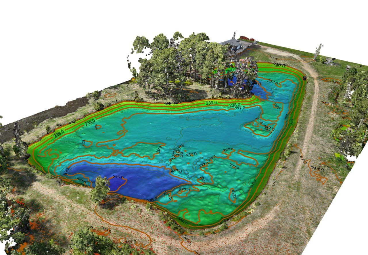
Survey control points are established on both banks and tied to a shared datum. All capture passes through that control so the final TIN is a true single surface — no manual stitching, no datum-shift artifacts, no "what does the bathy actually tie into" question for your designer.
Why It Matters For Your Project
A merged bank-plus-bottom surface is what your HDD designer needs to lay out a pilot bore, calculate depth-of-cover at the channel, and identify any no-drill zone driven by shallow bedrock or boulders. Two separate datasets create exactly the wrong kind of guesswork in the part of the design you can least afford to guess on.
For your hydrotechnical engineer, a fused TIN feeds scour analysis, channel migration assessment, and any HEC-RAS or similar modelling you have to support the crossing. The thalweg line, channel cross-sections, and bank geometry come out of one survey, with documented control, ready to model against.
For your environmental consultant, the OHWM line, riparian zone, fish-habitat base map, and high-resolution overhead imagery are the spatial layers their watercourse crossing application package needs. The geometry comes from us; your consultant builds the submission.
For your field schedule, capturing multiple crossings in a single 3–4 day mobilization means a multi-crossing pipeline program clears the Restricted Activity Period window in one push rather than staging multiple boat crews across the season.
Frequently Asked Questions
What accuracy can I expect on a river crossing survey?
Bank topography is typically 2–5 cm vertical from UAV LiDAR. River-bottom bathymetry is 5–10 cm depending on water depth, clarity, and turbulence. The fused TIN is delivered as a single seamless surface with documented control on both banks.
Do you provide the regulator submission package?
We deliver the engineering-ready data your environmental consultant or design engineer uses to build the regulator submission package. Our outputs — OHWM line, channel cross-sections, plan and profile, fish-habitat base map — are formatted to drop directly into your team's submissions.
Can you survey during high water or in fast currents?
Often yes. USV bathymetry operates safely where ground crews or manned boats can't. We schedule around Restricted Activity Periods specific to each watercourse and plan capture windows that work with seasonal flow and access constraints.
How quickly can I have the data after field work is complete?
Standard turnaround is 5–10 business days from field complete to final deliverables. Rush turnaround is available for time-critical HDD designs or compressed Restricted Activity Period schedules.
Can you handle multiple crossings on one pipeline program?
Yes. Multi-crossing programs are how we like to mobilize. A typical 3–4 day field trip covers 4–8 crossings depending on access. We deliver them as one consolidated package with a common control framework so your design team can compare crossings on apples-to-apples geometry.