How We Capture It
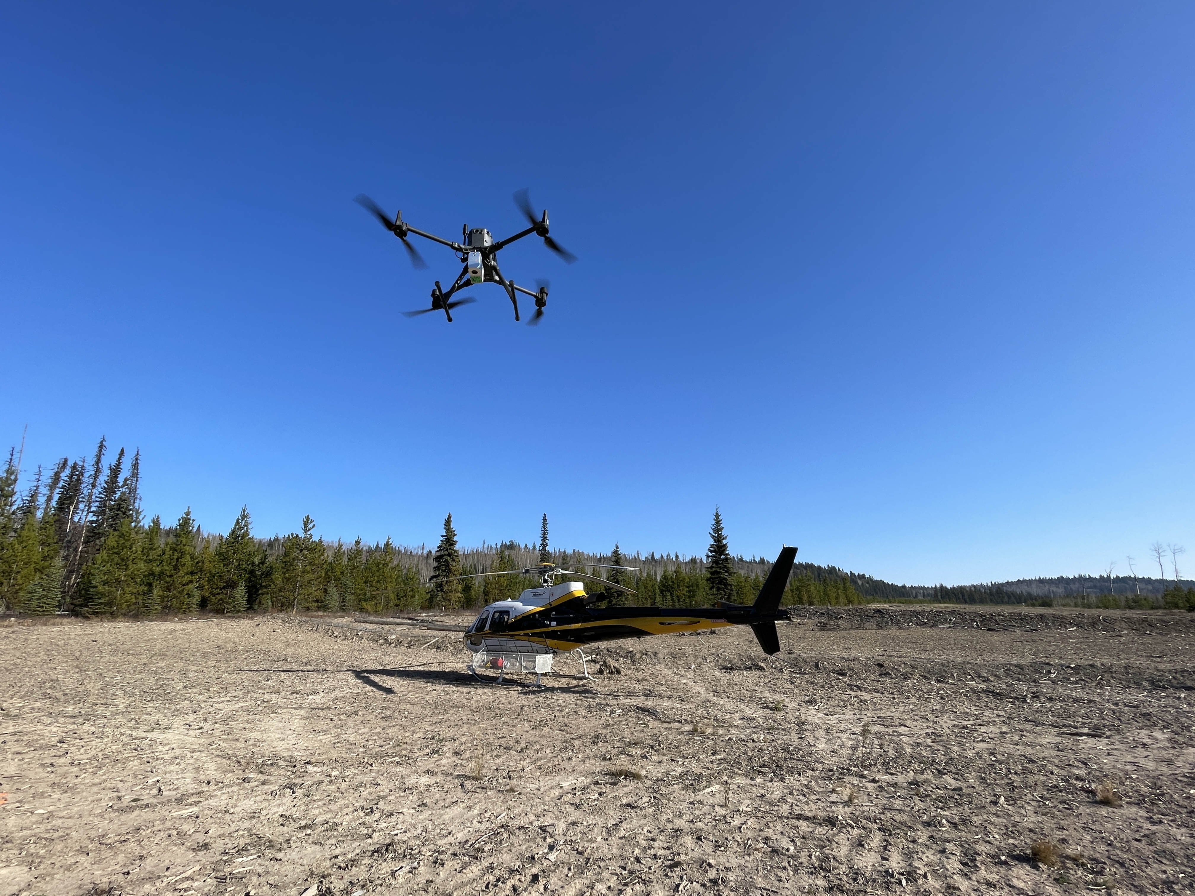
UAV LiDAR Over the Corridor
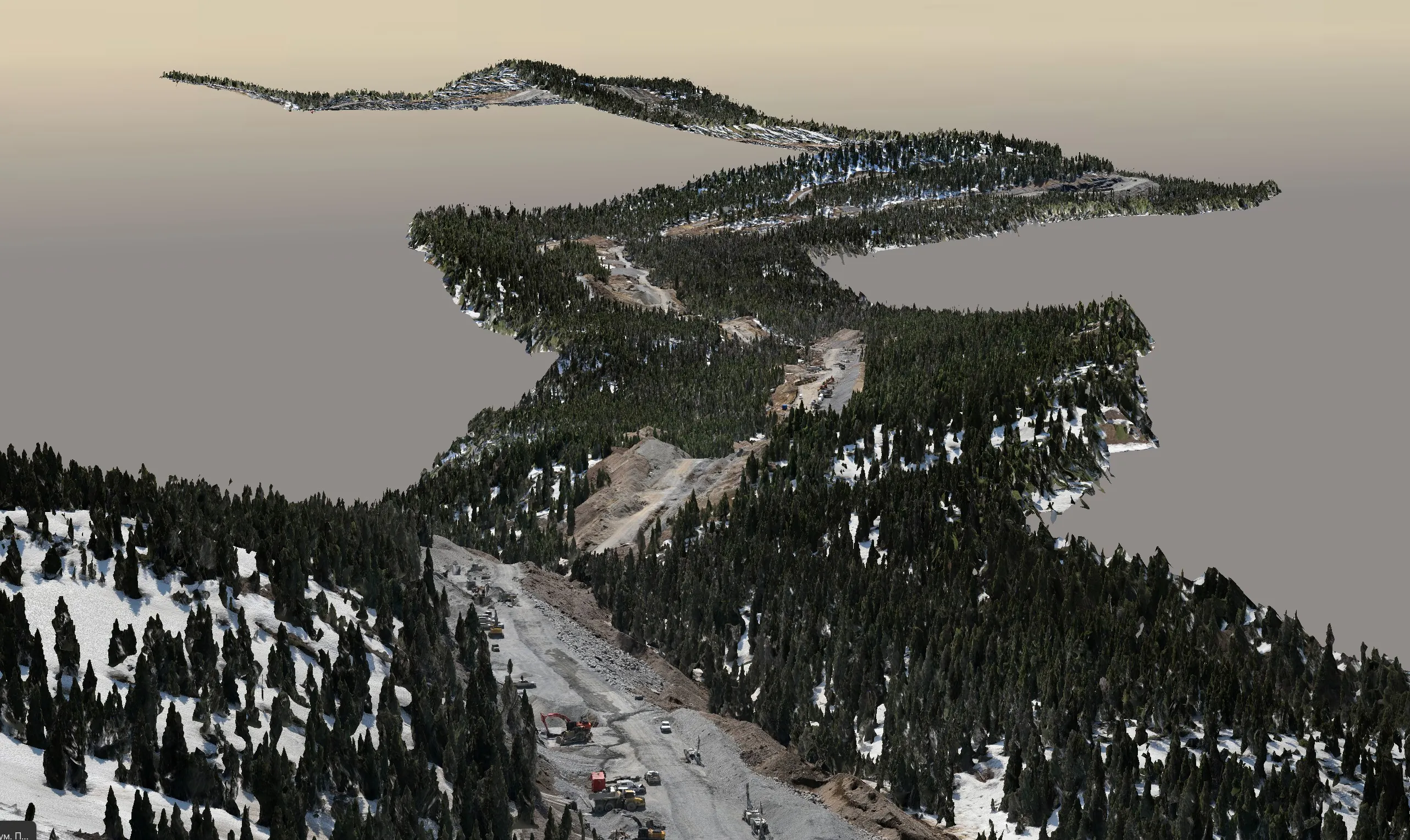
Drone-mounted LiDAR captures the corridor at typical 20–60 km of ROW per field day. Flight planning prioritises ground returns through any cover — settings tuned for the vegetation density of the specific corridor. The point cloud is classified to extract bare-earth ground, vegetation, structures, and water.
Fusion With Your AGM & Locator Data
Your AGM coordinates and locator depth readings come in as CSV or shapefile from your standard integrity workflow. We tie them onto the LiDAR ground surface using the AGM XY and locator-to-pipe vertical offsets. The result is a continuous pipe-elevation line referenced to the same coordinate system as the ground surface. Subtraction gives DoC at every locator station and a smooth interpolated DoC profile in between.
Exception Identification
You define the DoC threshold (typical operating thresholds, or specific regulatory minimums for road crossings, watercourse crossings, and developed areas). The deliverable flags every section where modelled DoC falls below threshold — ready for your integrity team to schedule walk-down verification or focused potholing.
No Ground Crew on the Corridor
UAV LiDAR captures the surface from above. No locator crew walking the line for the topo half of the work, no extra exposure on active ROW, no traffic accommodation for road crossings. Pair with mobile LiDAR from the road shoulder where a road parallels the corridor and the whole job runs without operator shutdown.
Why This Approach Beats Walking the Line
A walking crew with a pipe locator and RTK can absolutely produce DoC numbers — just slowly. On a long midstream corridor, a walking crew is a multi-week field engagement, with traffic accommodation at every road crossing, weather days, access negotiations, and crew fatigue. The deliverable arrives weeks after the integrity team needed it.
The UAV LiDAR surface plus your existing AGM data collapses that timeline to days. The ground surface comes from above. Your existing locator program supplies the pipe side. Fusion is desktop work. The integrity team gets a current DoC profile, exception zones, and statistics in time to act inside the same season they asked for the survey.
For corridors where AGM coverage is patchy, we can pair the LiDAR surface with targeted ground locating — either by your team or coordinated subcontract — to fill gaps. The principle stays the same: surface from above, pipe from ground, fused on the desktop.
Frequently Asked Questions
How fast can you survey a long pipeline corridor?
UAV LiDAR capture rates are typically 20–60 km of corridor per field day depending on terrain, access, and flight conditions. A 200 km corridor that would take a walking crew weeks of field time is captured in roughly 3–5 days of flying, plus data processing.
What accuracy do you achieve on the ground surface?
Bare-earth surfaces from UAV LiDAR are typically 2–5 cm vertical with proper ground control. Multi-return scanning penetrates dense vegetation to give a clean bare-earth model along the pipeline ROW.
How do you fuse our AGM and locator data with your surface?
Your AGM coordinates and locator depth readings come in as CSV or shapefile from your standard integrity workflow. We tie them onto the LiDAR ground surface using the AGM XY and locator-to-pipe vertical offsets, producing a continuous pipe-elevation line and a DoC value at every locator station. Exception zones (DoC below your operating threshold) come out flagged on the deliverable.
Can you survey active corridors without operator shutdown?
Yes. UAV LiDAR captures the ground surface from above without any ground crew on the line and without operator shutdown. Where the corridor parallels a road, we can add mobile LiDAR from the road shoulder so the entire dataset is collected without lane closures or Traffic Accommodation submissions.
What if our AGM coverage is patchy?
We can pair the LiDAR surface with targeted ground locating — either by your team or coordinated subcontract — to fill gaps. The principle is the same: surface from above, pipe from ground, fused on the desktop.