About Convex Geomatics

A second-generation, family-owned Alberta surveying team — blending traditional surveying craft with UAV LiDAR, mobile mapping, USV bathymetry, photogrammetry, and 3D modeling to deliver precise, actionable data since 2020.

Our Story

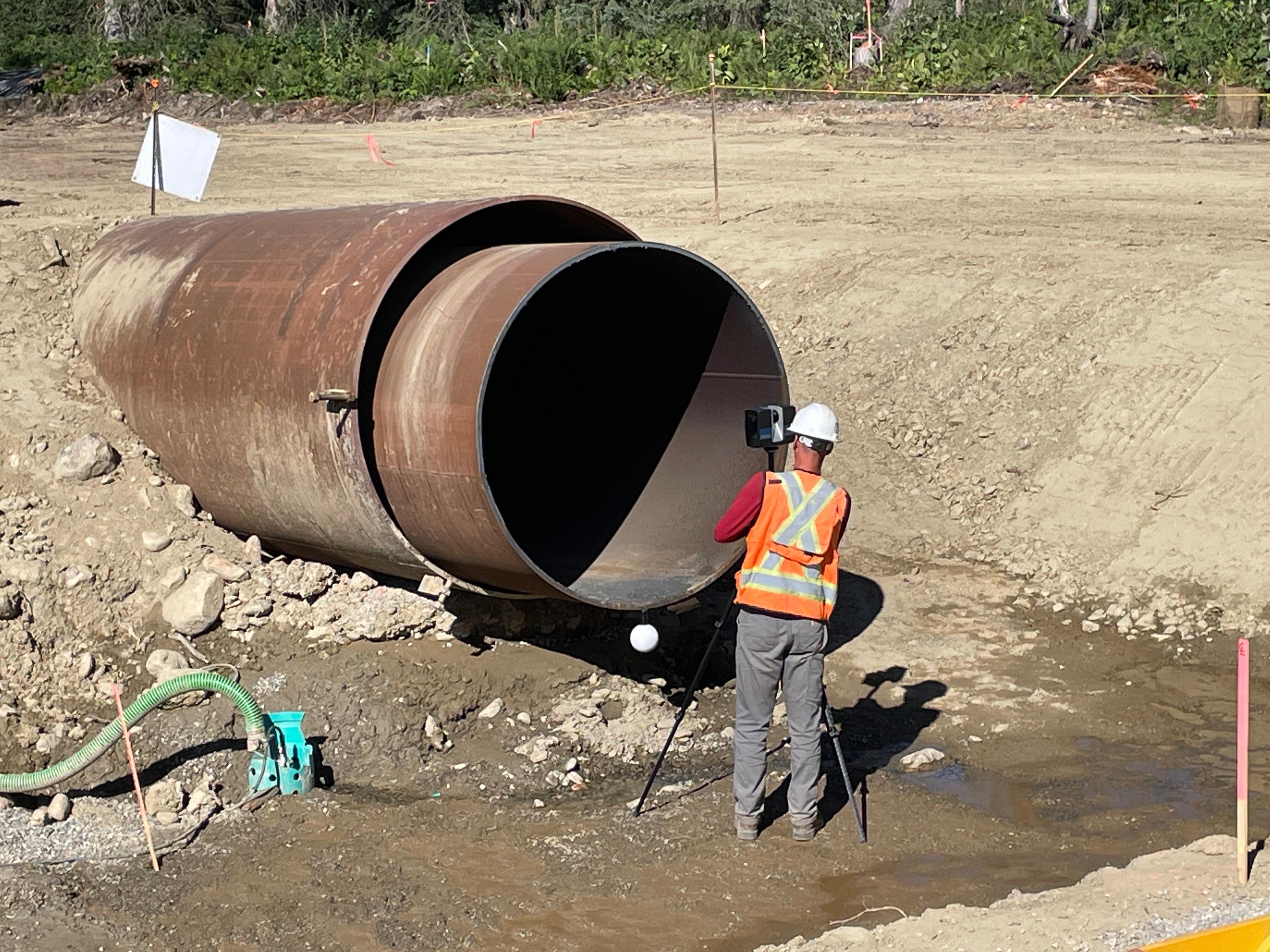
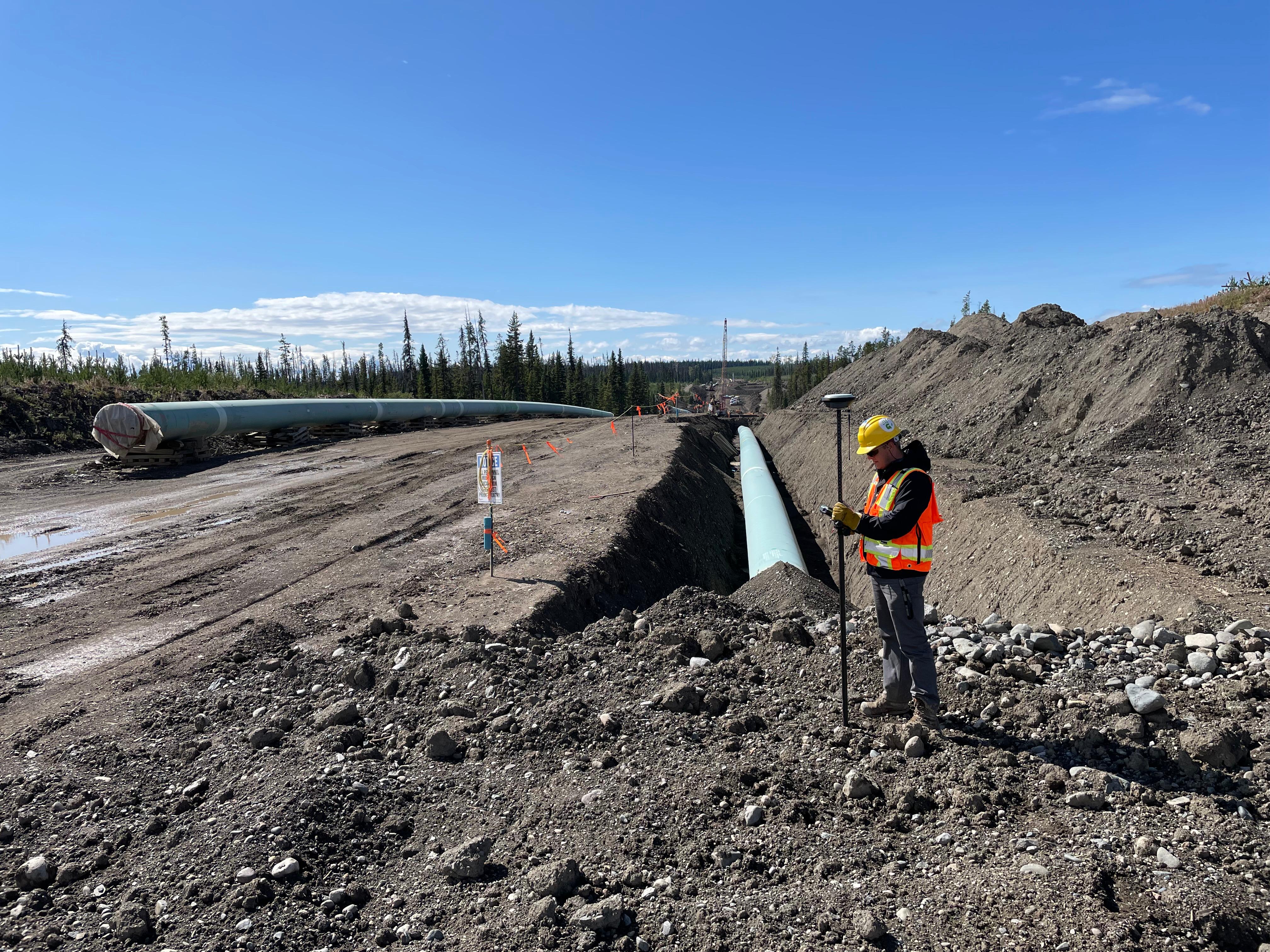
Convex Geomatics Ltd. is a second-generation, family-owned Calgary geomatics firm (founded 2020) delivering precision LiDAR surveying, UAV and airborne mapping, mobile mapping, bathymetric surveys, 3D laser scanning, and road condition assessments. We also provide topographic and as-built surveys, photomapping, monitoring, and construction layout. Surveying is our craft, our passion, and our family trade — the discipline we grew up in.

With 45+ years of combined experience across Europe and Canada, we support oil & gas, complex construction, transportation, utilities, forestry, and environmental projects. From survey control to point-cloud processing, classification, and CAD/GIS deliverables, we supply accurate, defensible data that moves projects from field to finish on time and on budget.

We are always learning. New sensors, new processing methods, new ways of getting more accurate data with less time in the field. When something genuinely makes the work better — faster capture, tighter accuracy, safer access, cleaner deliverable — we adopt it. When it is marketing dressed up as innovation, we leave it alone. The test is always the same: does this make the deliverable better for the client?

We listen to the client first. The capture method comes after we understand what the deliverable has to do.

At a Glance

2020
Year Founded
45+ years
Combined Experience
200+ km
Corridors Surveyed
24/7
Mobilization Window*

*As permitted by access and regulatory constraints.

Mission & Values

Action Over Talk

We're doers — meetings are short, results are sharp, and execution is everything. Less talk, more delivered work.

Innovation Without Noise

We cut through buzzwords — our innovation is practical, tested, and built to perform. We use UAV and mobile LiDAR, manned aircraft, SLAM, and GIS to improve safety, speed, and data completeness.

Discipline Drives Excellence

We don't just meet deadlines — we master them. Disciplined workflow, repeatable processes, and consistent QC/QA are how every project lands accurate and on schedule.

Simplicity Wins

In a world drowning in complexity, we keep things clear. Whether it's how we communicate or how we deliver — simplicity makes us faster, sharper, and easier to work with.

Safety First

We plan safe, work safe, go home safe. Pre-job checks, UAV checklists, and PPE — every shift, every site.

Accountability at Every Level

We own our outcomes — good or bad. Everyone on our team is trusted to lead, act, and deliver. There's no hiding behind titles. Results speak.

Leadership

Oskars Kreilis, Founder & CEO

Oskars Kreilis

Founder & CEO

Martins Kreilis, Founder & President

Martins Kreilis

Founder & President

Our Timeline

2020

Convex Geomatics is founded

Established in Calgary with a focus on high-accuracy land surveying and construction layout.

2022

First UAV LiDAR deployments

Expanded into aerial mapping to improve coverage, safety, and project turnaround.

2023

Pipeline Corridor Survey & Mapping (LiDAR + Photomapping)

Surveyed and mapped a multi-kilometre pipeline corridor using LiDAR and photomapping, with rigorous QA/QC.

2023

Mobile LiDAR Mapping (LiDAR + SLAM)

Integrated vehicle-mounted LiDAR and handheld SLAM into our workflow to enhance coverage and safety.

2024

Bathymetry & asset management

Added hydrographic capability and GIS deliverables for municipalities and utilities.

2025 - Present

Integrated geospatial services

Unified topo/as-built, LiDAR, and monitoring services delivering design-ready, construction-ready, and closeout packages.

Certifications & Safety

Our crews are trained to meet Canadian OHS standards. We maintain current training, complete required orientations, and follow documented safe-work procedures.

  • Advanced UAV pilot certification
  • First Aid/CPR, CSTS, WHMIS
  • Job hazard assessments (JHA/JSA/FLHA)
  • We maintain an active WCB-Alberta account in good standing.

Careers

We're always looking for curious surveyors and geospatial specialists who care about craft and client success.

Send Your Resume

What Makes Us Different

We listen, then propose

Before quoting, we want to understand what the data has to support — HDD design, regulator submission, construction layout, volume reconciliation, deformation tracking. If a different approach saves time or money without compromising accuracy, we say so — even when it means a smaller job for us.

Deliverable-first thinking

We start from the deliverable the client needs and engineer the capture method backwards from there. Faster turnaround, cleaner handover, fewer surprises during design.

Multi-sensor fusion in one mobilization

UAV LiDAR plus USV bathymetry. Mobile mapping plus terrestrial scanning. Photomapping plus point cloud. One trip, one consolidated dataset, no stitching gaps.

Alberta know-how

We know the access, the seasonal windows, the muskeg, the foothills weather. Local context shows up in safer field operations and more realistic project schedules.

Where We Work

We are headquartered in Calgary and work across Alberta, British Columbia and Saskatchewan. Our regular Alberta service area includes Calgary, Edmonton, Red Deer, Fort McMurray, Lethbridge, Grande Prairie, Lloydminster, Medicine Hat, Vermilion, Sylvan Lake, Olds, Stettler, Camrose, Wetaskiwin, Drumheller, Lacombe, Wainwright, Bonnyville, Cold Lake, Brooks, Taber, Hinton, Peace River, Slave Lake and surrounding communities. Cross-border pipeline, transportation and mining projects routinely take us into BC and SK.

Geographic spread matters because Alberta projects are not all the same. The conditions on a foothills bridge survey are nothing like a north-east pipeline corridor through muskeg, and neither resembles a downtown Edmonton mobile mapping job. Working across the province keeps our crews and sensors ready for the conditions a given site actually presents.

Frequently Asked Questions

Where is Convex Geomatics based and where do you work?

Calgary, Alberta. We work across all of Alberta — Edmonton, Red Deer, Fort McMurray, Lethbridge, Grande Prairie, Medicine Hat and more than 20 other communities — and routinely deploy into British Columbia and Saskatchewan for cross-border pipeline, transportation and mining projects.

What makes Convex Geomatics different?

We are second-generation surveyors. Surveying is our family craft and our passion. We combine traditional surveying discipline with current sensor technology — UAV LiDAR, mobile mapping, USV bathymetry, photogrammetry and 3D modeling are all in-house capabilities. We focus on the deliverable: clients tell us what the data needs to do, and we engineer the capture method backwards from that outcome.

What projects do you typically take on?

Energy and pipeline (corridor mapping, river crossings, depth-of-cover), mining and aggregates (volumes, stockpiles, tailings bathymetry), civil and transportation (roads, bridges, intersections), municipal (topographic, as-built), and environmental and hydrology (lake bathymetry, shoreline, deformation monitoring). The common thread is engineering-grade accuracy with a deliverable a design team can use the same day.

How quickly can you deliver?

Standard turnaround on most projects is 5–10 business days from field complete to final deliverable. Rush turnaround is available for time-critical designs, regulator deadlines or compressed construction windows.

How do you approach a new project?

We listen first. Before quoting, we want to understand what the data has to support — design, regulator submission, construction layout, monitoring. From there we propose the capture method and deliverable format that fits, often combining two or more sensors in one mobilization. If a different approach is genuinely better for the client, we will say so.

Start with precision. Build with confidence.

From field to finish — precise data, on-spec deliverables, responsive support.

Company Profile (PDF) Contact Us