Office (Calgary)
103 Riverglen Cres SE, Calgary, AB T2C 3J3
Precision UAV & manned LiDAR, mobile mapping, bathymetric surveys, 3D modeling, and volumetric calculations. Accurate data. Fast turnaround. Local experts you can trust.
Comprehensive geospatial solutions tailored to your project requirements across Calgary and Alberta
Survey-grade airborne LiDAR surveys using UAV and manned aircraft for precise mapping with centimetre-level accuracy.
UAV & Manned Aircraft LiDAR SurveysProcessing raw LiDAR data into design-ready maps and models for CAD/GIS workflows.
LiDAR & Point Cloud ProcessingVehicle-mounted LiDAR and imaging for rapid 3D capture of roads, utilities, and interiors.
Mobile LiDAR MappingHydrographic mapping using unmanned surface vessels for safe depth measurements in water bodies.
Bathymetric SurveyMeasuring road condition and geometry using mobile LiDAR for quality assurance and metrics computation.
Road Condition & QA SurveysAerial mapping producing orthomosaics, point clouds, and 3D models with survey-grade accuracy.
Photogrammetry & 3D ModelingTopographic and as-built surveys using GNSS, LiDAR, and total stations for CAD-ready basemaps.
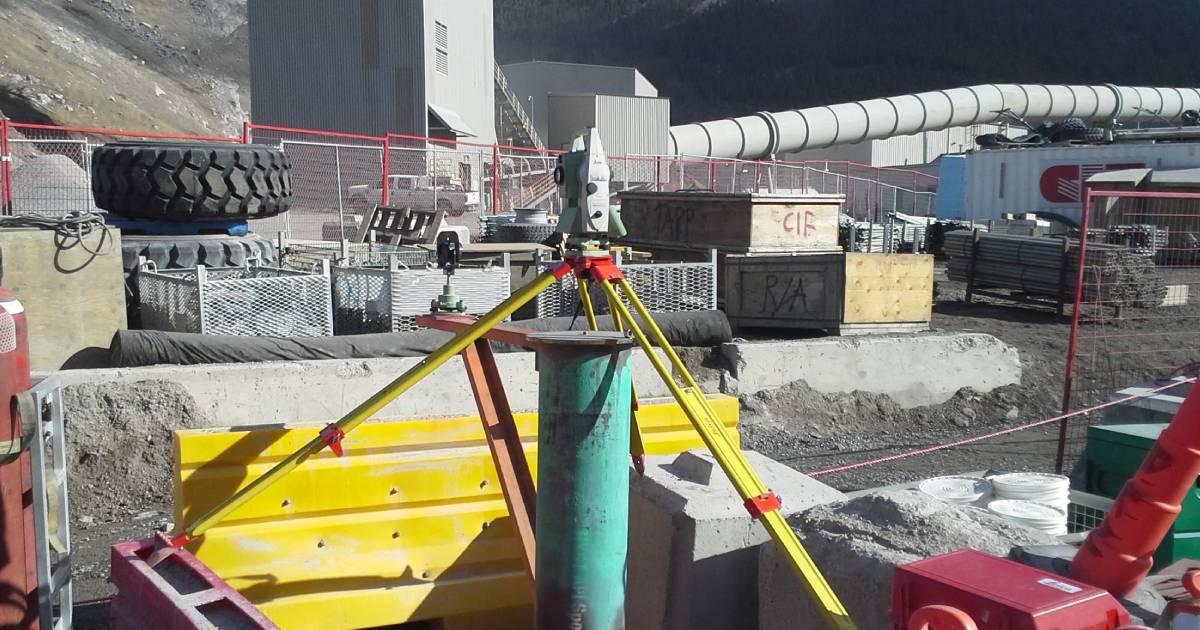
Topographic & As-Built SurveysConstruction layout, monitoring, and control using precise staking and verification services.
Construction Layout & MonitoringVolumetric calculations for stockpiles and earthworks using UAV LiDAR and photogrammetry.
Volumetric & Earthwork SurveysNew · Interactive Demo
Rotate, zoom, measure. An interactive 3D digital twin of a producing Alberta wellsite, built from UAV LiDAR and photogrammetry. Try the public demo — production deliveries are private via Convex Geoportal.
Open Interactive Demo →Trusted across Alberta’s most demanding sectors — from energy corridors to civil construction and municipal works
A disciplined, repeatable process from first call to final deliverable — designed to keep your project on schedule and on spec
Tolerances, deliverables, datums, access & safety reviewed up front.
UAV, mobile, and conventional crews collect survey-grade data fast.
Classification, modeling, and independent QA against documented control.
CAD/GIS deliverables, signed reports, and ongoing project support.
From Calgary’s growing urban areas to the rugged foothills, boreal forests, and energy corridors, Alberta demands surveying that handles tough terrain, harsh weather, and tight timelines. As a locally owned Calgary firm with over 45 years of combined experience, we deliver millimetre-accurate data with fast turnaround and practical solutions tailored to real Alberta projects.
Recent geospatial work across Calgary, Alberta, and beyond
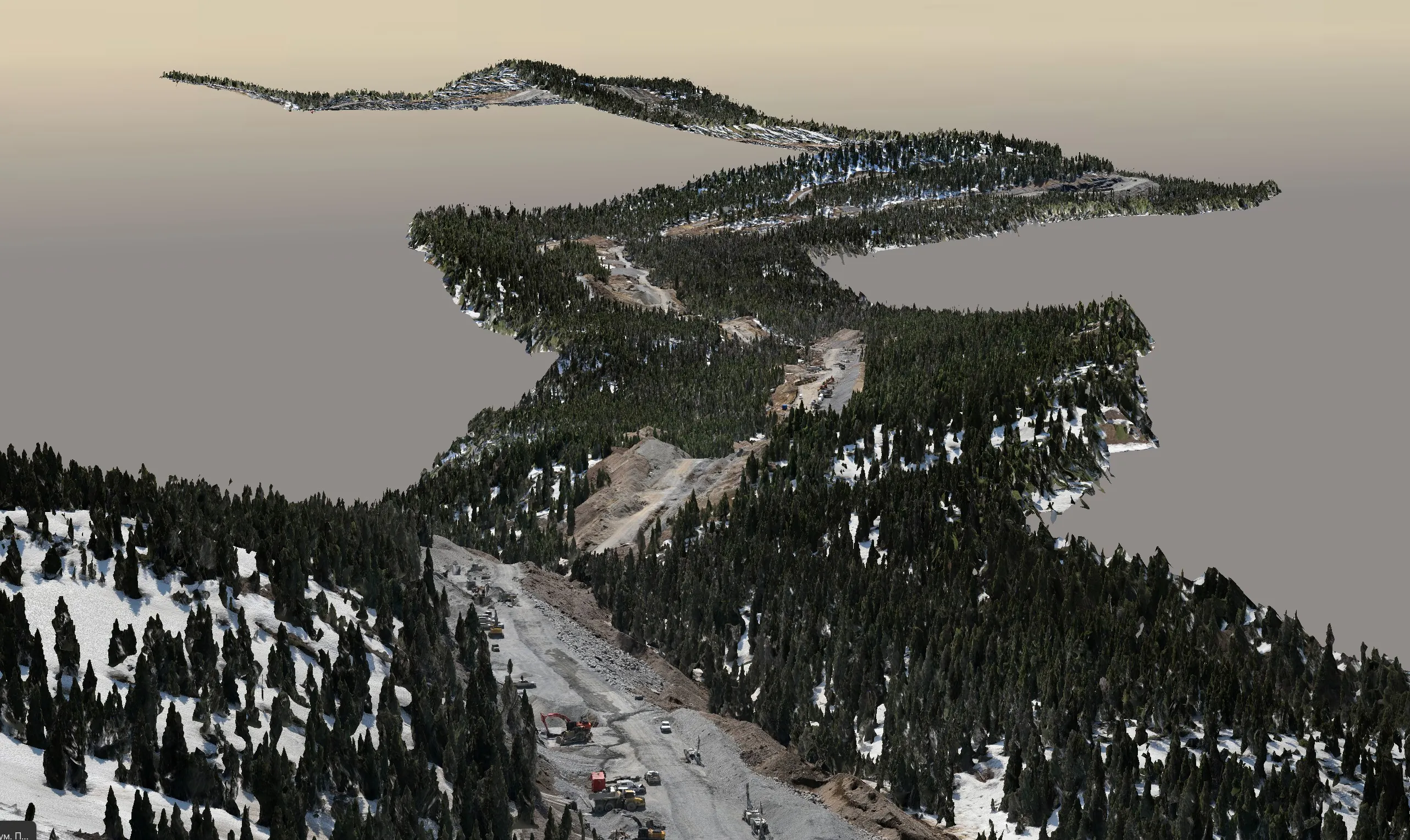
High-resolution LiDAR scanning of 200 km of pipeline corridor for accurate as-built documentation and verification.
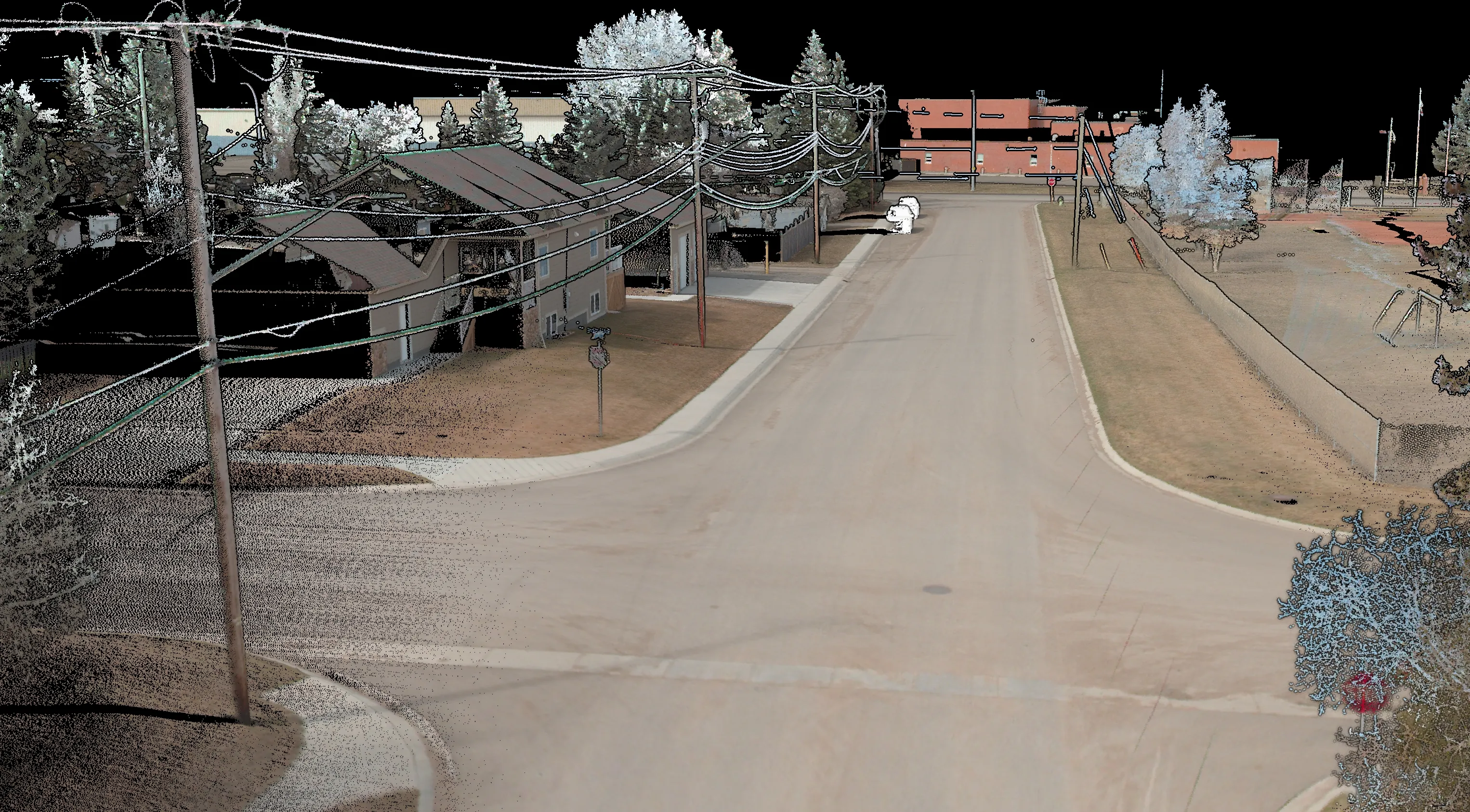
Comprehensive 3D mapping of an entire town using mobile LiDAR for detailed asset management and GIS integration.
Founded in 2020 and based in Calgary, Convex Geomatics is a locally owned company specializing in precision geospatial solutions. With over 45 years of combined experience, we blend traditional surveying expertise with advanced UAV LiDAR, mobile mapping, bathymetric surveys, and 3D modeling to deliver accurate, actionable data for engineering, construction, energy, and environmental projects across Alberta.
We pride ourselves on fast turnaround, clear communication, and practical deliverables that help our clients make confident decisions — whether from the office or in the field.
Field notes, technical guides, and project lessons from our Calgary team.
 Construction
Where tolerances and monitoring thresholds intersect on construction sites — what the numbers really mean for your project.
Read article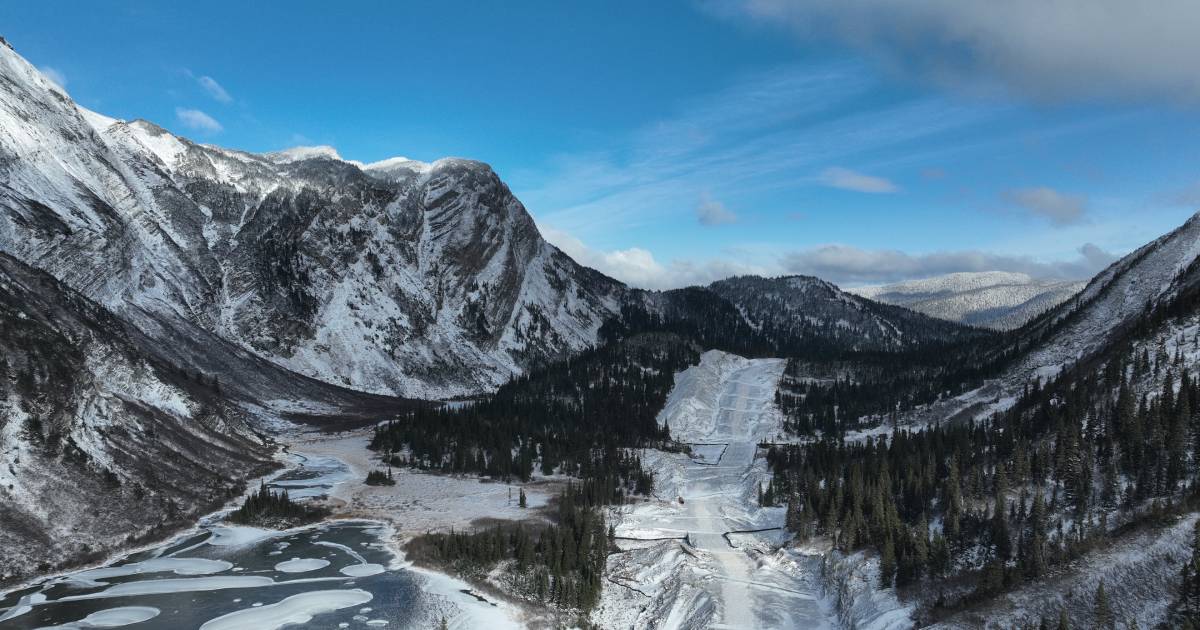 LiDAR
LiDAR
Choosing the right capture method for sites with vegetation, weather, and seasonal challenges.
Read article 3D Modeling
Living digital models that evolve with monitoring data and field updates — the next generation of asset visualization.
Read articleCommon questions about our surveying and geomatics services in Alberta.
We provide UAV and manned aircraft LiDAR surveys, mobile LiDAR mapping, bathymetric surveys, photomapping & 3D modeling, topographic & as-built surveys, road quality assurance, construction layout, structural and deformation monitoring, and volumetric/earthwork calculations across Alberta and Western Canada.
For most Alberta projects we can mobilize within 2–5 business days. Time-critical work — incident response, monitoring deployments, or as-built acceptance — can be on site in 24–72 hours depending on access and weather.
Typical accuracies: UAV LiDAR ±3–5 cm, mobile LiDAR ±2–3 cm, robotic total station ±5–15 mm, monitored prism networks ±0.5–1.5 mm, and bathymetric surveys ±5–10 cm. Results depend on control quality, sensor configuration, and site conditions.
Yes — we deliver layered DWG/DXF, LandXML, TIN/DTM/DSM, classified LAS/LAZ point clouds, GeoTIFF, SHP/GDB, CSV, and PDF maps aligned to your standards. A README documents projection, datum, units, and file structure for easy onboarding.
Yes — we work across Alberta, BC, Saskatchewan and the rest of Western Canada, including Edmonton, Fort McMurray, Red Deer, Lethbridge, and the foothills/oilsands regions. Remote sites and corridor projects are part of our core work.
Ready to discuss your project? Our Calgary-based team is here to help with UAV LiDAR, bathymetric surveys, 3D modeling, or any other surveying needs across Alberta.
103 Riverglen Cres SE, Calgary, AB T2C 3J3