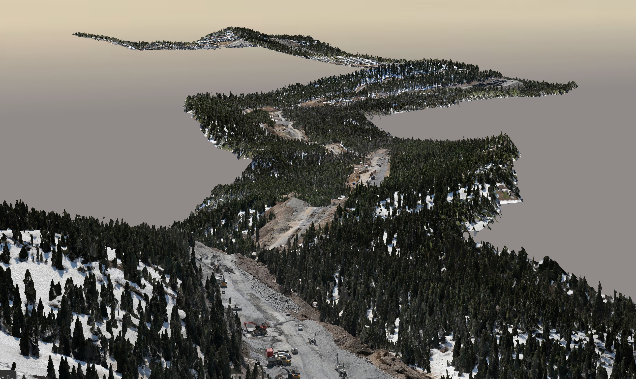
In the ever-evolving world of geospatial technology, mobile mapping has emerged as a revolutionary method for collecting highly accurate and comprehensive data. This cutting-edge technology combines various sensors, such as LiDAR, cameras, and GPS, mounted on mobile platforms, enabling the rapid capture of geospatial data on the go. In this blog, we delve into the advancements and benefits of mobile mapping technology, highlighting how Convex Geomatics leverages this innovation to provide efficient and versatile geospatial solutions.
The Power of Mobile Mapping Technology
Mobile mapping technology has redefined the landscape of data collection, offering a unique blend of precision, speed, and adaptability. By integrating multiple sensors into a single mobile system, such as a vehicle or drone, mobile mapping allows for the simultaneous collection of various types of data, including 3D point clouds, high-resolution imagery, and precise geographic coordinates. This fusion of data types enables a comprehensive analysis of the surveyed environment, making it an invaluable tool for numerous applications.
Convex Geomatics utilizes state-of-the-art mobile mapping systems equipped with advanced LiDAR sensors, panoramic cameras, and high-accuracy GPS units. This combination ensures that every detail is captured with unparalleled accuracy, whether mapping complex urban landscapes, conducting road surveys, or managing utility infrastructure. The ability to collect data while in motion not only speeds up the surveying process but also minimizes the need for extensive ground-based surveys, reducing costs and improving efficiency.
Efficiency and Versatility in Geospatial Data Collection
One of the most significant advantages of mobile mapping is its efficiency. Traditional surveying methods can be time-consuming and labor-intensive, often requiring extensive manual measurements and data processing. In contrast, mobile mapping systems can cover large areas quickly, capturing vast amounts of data in a fraction of the time. This efficiency is particularly valuable for projects with tight timelines or those requiring frequent data updates.
The versatility of mobile mapping technology is another key benefit. It can be applied to a wide range of projects, from urban planning and infrastructure management to environmental monitoring and disaster response. For instance, in road surveys, mobile mapping can provide detailed information about road conditions, signage, and traffic flow, supporting maintenance and planning efforts. In utility management, it enables the precise mapping of underground utilities and above-ground assets, facilitating maintenance and minimizing the risk of service interruptions.
Case Studies: The Impact of Mobile Mapping
Road Surveys and Infrastructure Management
One compelling case study involves the use of mobile mapping for road surveys and infrastructure management. Convex Geomatics was tasked with mapping a complex urban road network to support a city-wide infrastructure upgrade. By deploying mobile mapping vehicles equipped with LiDAR and cameras, the team was able to quickly and accurately capture detailed data on road geometry, surface conditions, and existing infrastructure. The resulting data was used to develop a comprehensive digital model of the road network, which guided the planning and execution of road improvements. The use of mobile mapping not only reduced the time required for data collection but also provided more accurate and detailed information than traditional methods, leading to better decision-making and project outcomes.
Utility Management and Asset Mapping
In another project, Convex Geomatics utilized mobile mapping technology to map utility assets across a large metropolitan area. The goal was to create a precise and up-to-date inventory of underground and above-ground utilities, including water lines, electrical cables, and gas pipelines. The mobile mapping system, equipped with advanced sensors, captured high-resolution data on the location and condition of these assets. This data was then integrated into a geographic information system (GIS), providing utility managers with a comprehensive and easily accessible view of their infrastructure. The project not only improved asset management and maintenance planning but also helped prevent accidental damage during construction activities.
Real-Time Data and Large-Scale Projects
One of the unique advantages of mobile mapping is its ability to provide real-time data updates. This capability is particularly valuable for large-scale projects or situations where conditions change rapidly, such as in disaster response scenarios. For example, in the aftermath of a natural disaster, mobile mapping can quickly assess damage to infrastructure and provide real-time updates to emergency responders and planners. This rapid assessment capability supports timely decision-making and resource allocation, helping to mitigate the impact of the disaster.
Conclusion: The Future of Geospatial Solutions
As technology continues to advance, mobile mapping is poised to play an increasingly vital role in geospatial data collection and analysis. Its ability to capture highly accurate and comprehensive data on the go offers unparalleled efficiency and versatility, making it an ideal solution for a wide range of applications. At Convex Geomatics, we are committed to harnessing the power of mobile mapping technology to deliver innovative and effective geospatial solutions for our clients.
By transforming the way data is collected and analyzed, mobile mapping is not only revolutionizing the field of geospatial technology but also unlocking new possibilities for urban planning, infrastructure management, environmental monitoring, and beyond. As we look to the future, the continued integration of advanced sensors and real-time data processing will further enhance the capabilities of mobile mapping, providing even more precise and actionable insights for decision-makers.
In a world where accurate and timely data is more critical than ever, mobile mapping stands out as a game-changing technology that is reshaping the landscape of geospatial solutions. With its combination of precision, speed, and versatility, mobile mapping is not just a tool for today but a cornerstone for the future of efficient and effective geospatial data collection.